

Directive 2007/60/EC on flood risk assessment and management aims to reduce the adverse consequences for human health, the environment, cultural heritage and economic activity associated with floods. To this end, Member States are required to identify river basins and coastal areas at risk of flooding, to draw up flood risk maps and to draw up flood risk management plans for those areas.
The primary information on floodplains was made by the Basin Water Administrations, through the Flood Defense Offices under the technical coordination of the National Institute of Hydrology and Water Management (INHGA), which prioritized, selected and validated the information provided from the territory.
All tabular and GIS data were produced in accordance with the requirements of the Floods Directive 60/2007/EC, using the methodologies developed by INHGA. This data is also included in county-level defense plans.
Among the natural phenomena that cause victims and negatively affect human activities, floods are those which, by their proportions and frequency, have the most serious consequences. The 39 selected nationally significant historical events resulted in 237 casualties, averaging approximately 6.6 victims per event. A graphical representation of victims and the number of national events recorded by each Basin Administration is shown in figure 1.

Figure 1. Graphical representation of the number of significant national events and associated victims, by Basin Water Administration
Among the natural phenomena that cause victims and negatively affect human activities, floods are those which, by their proportions and frequency, have the most serious consequences. The 39 selected nationally significant historical events resulted in 237 casualties, averaging approximately 6.6 victims per event. A graphical representation of victims and the number of national events recorded by each Basin Administration is shown in figure 1.

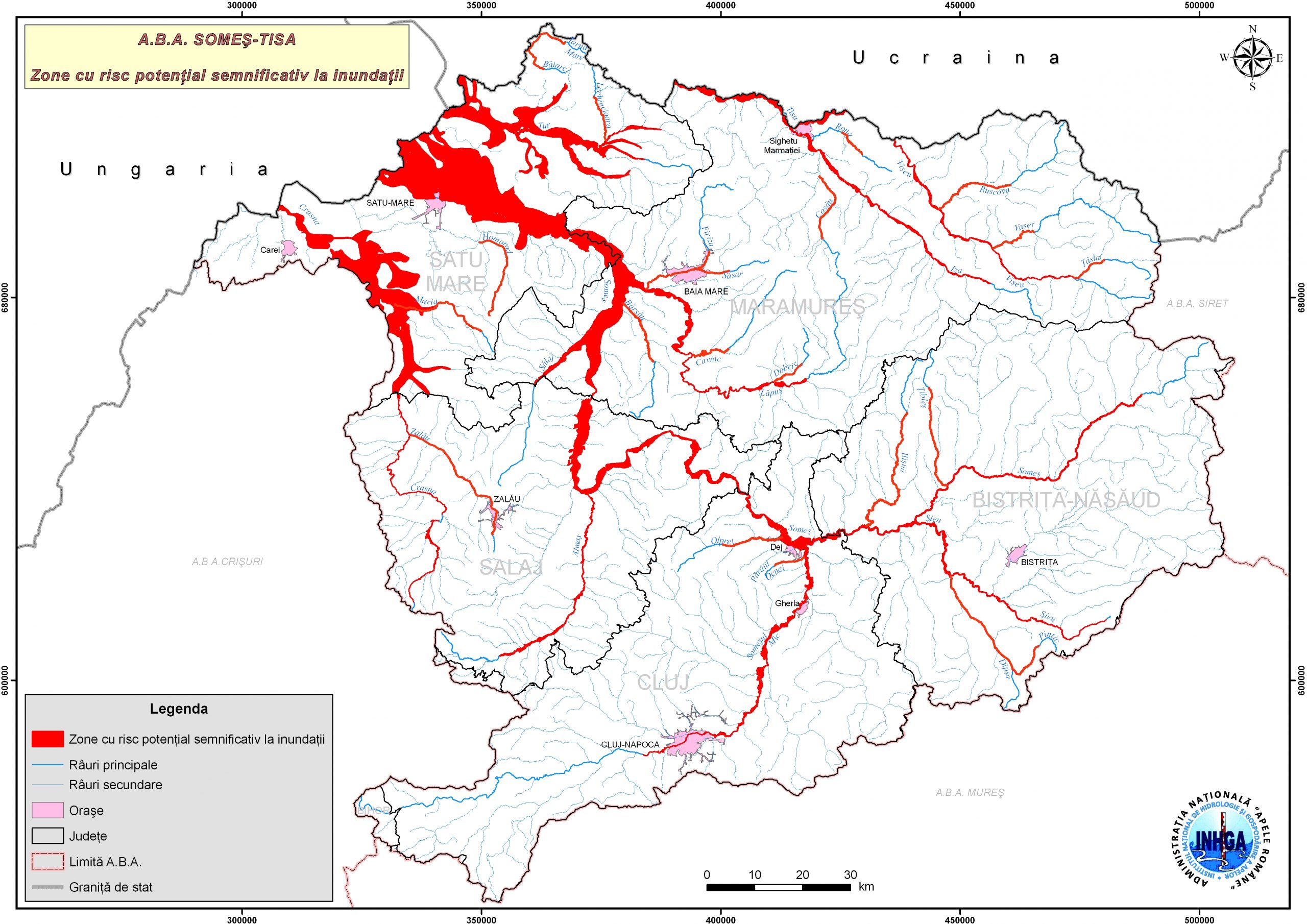
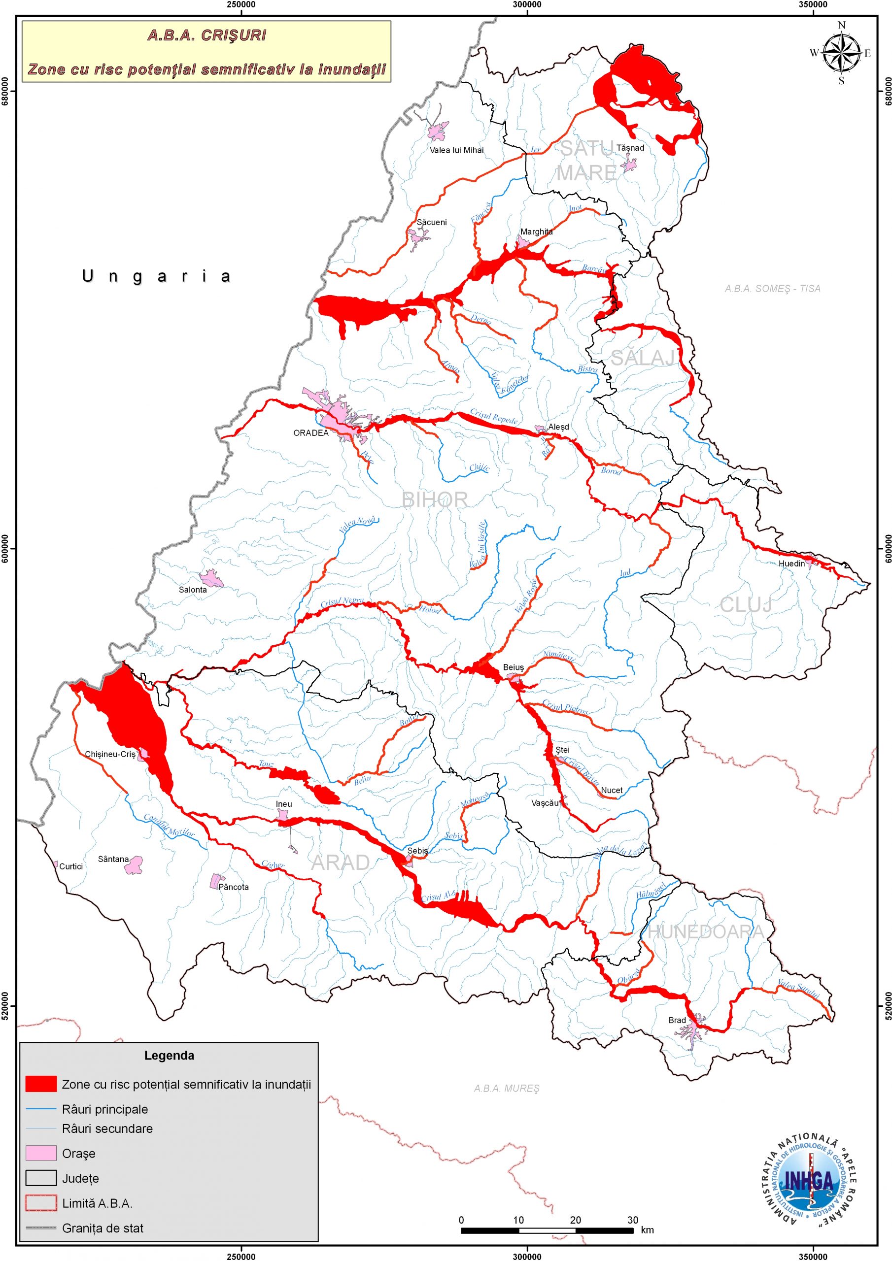
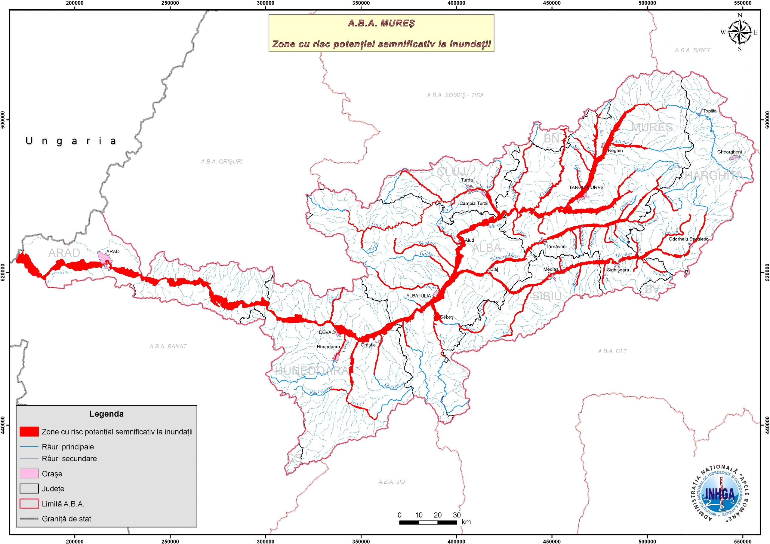
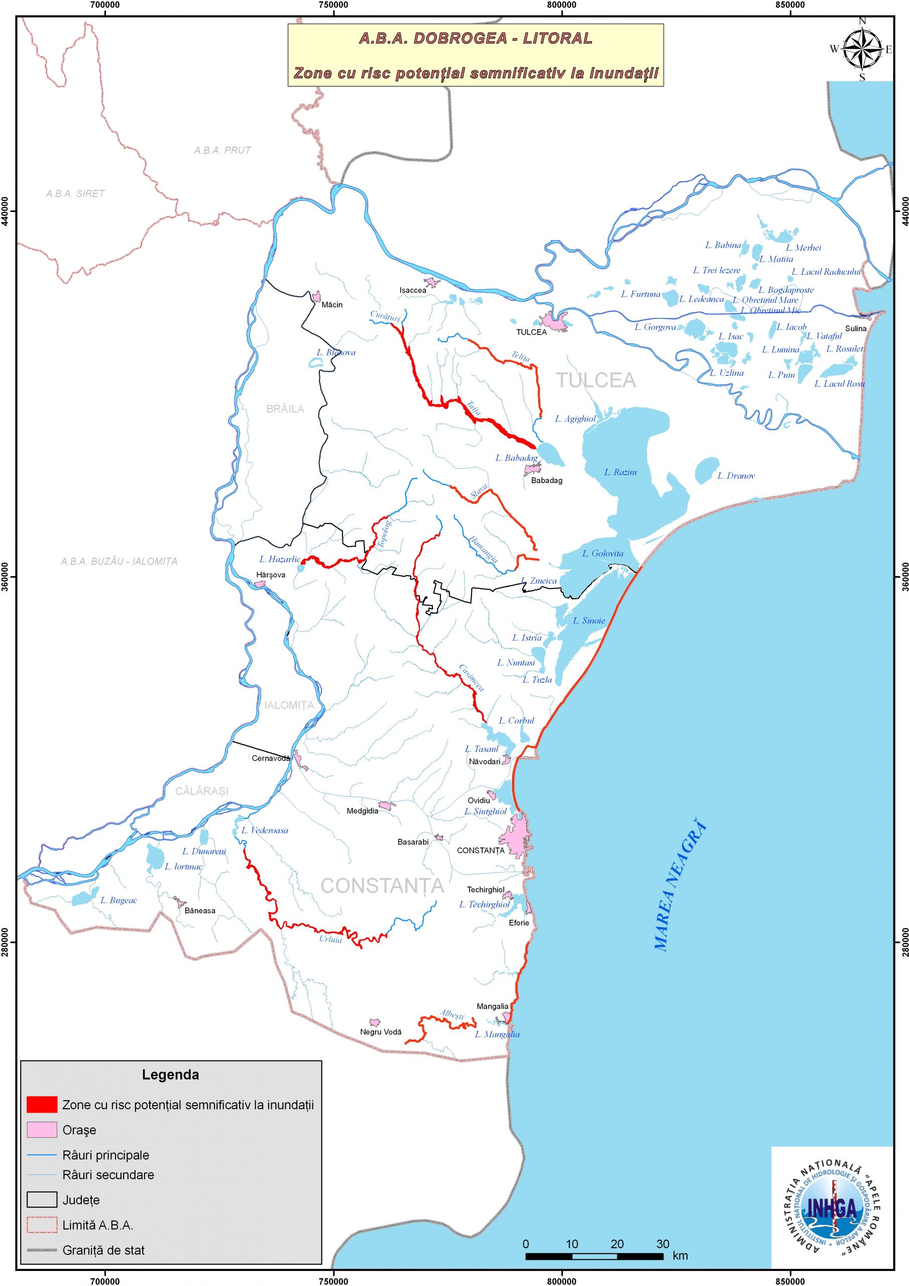
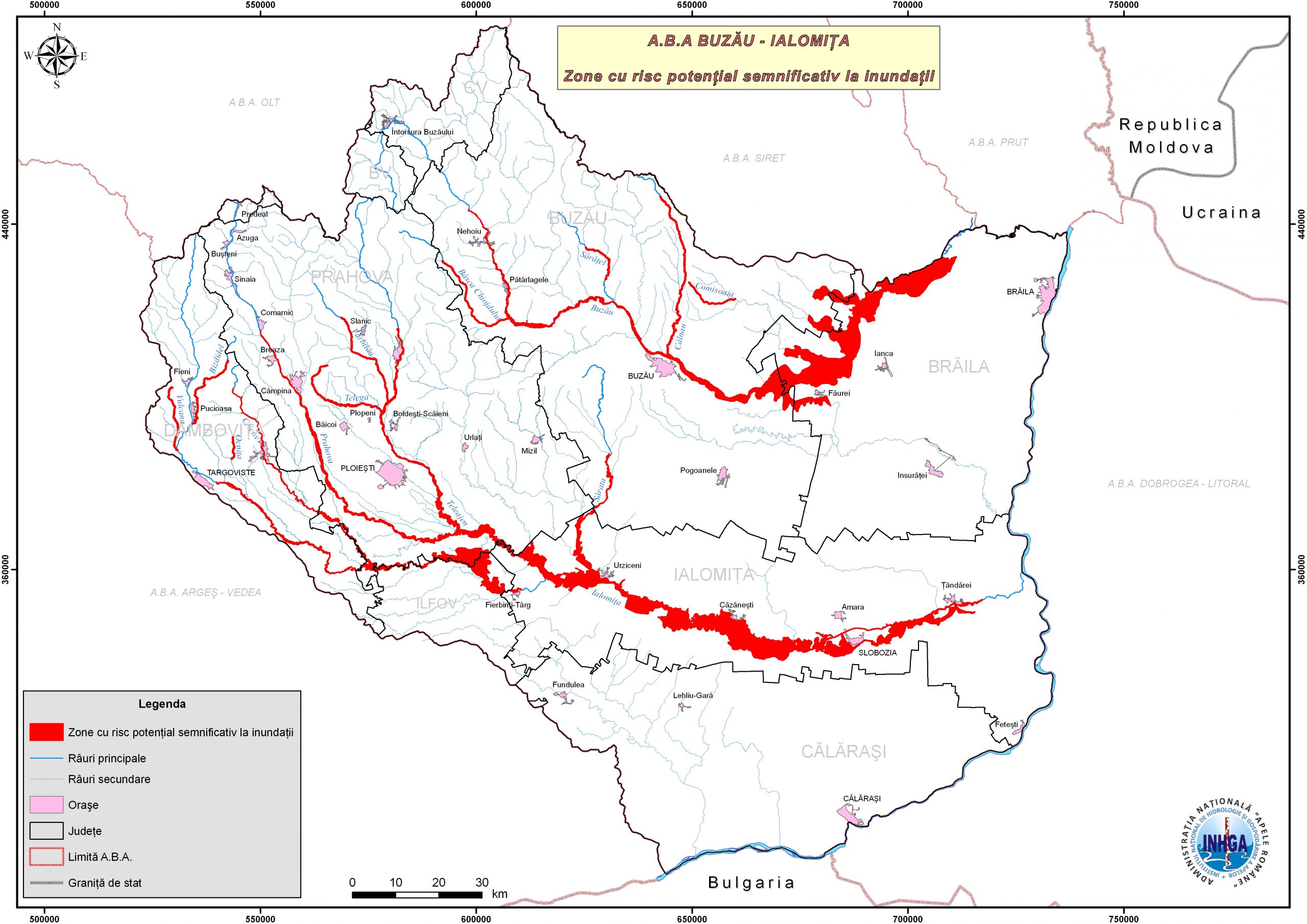
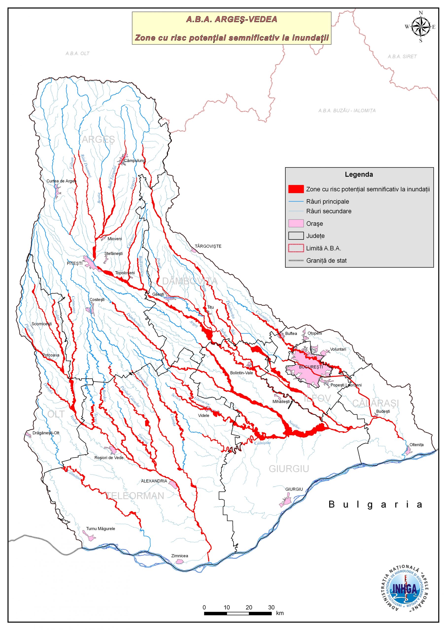
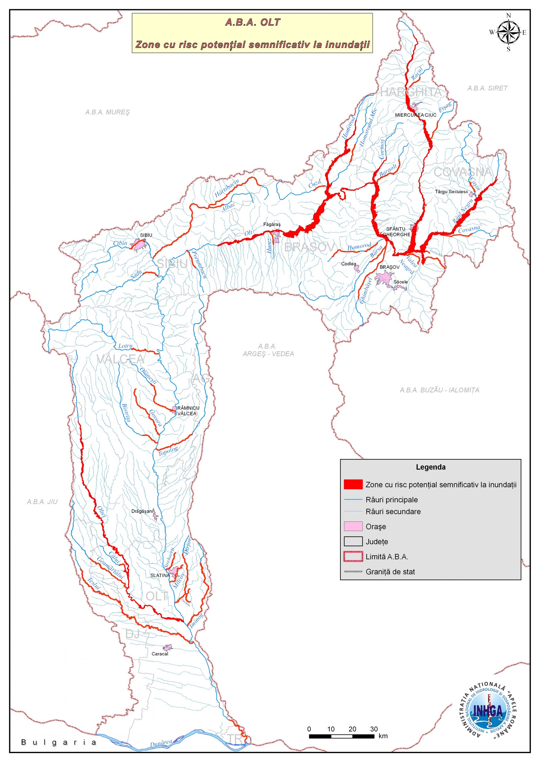
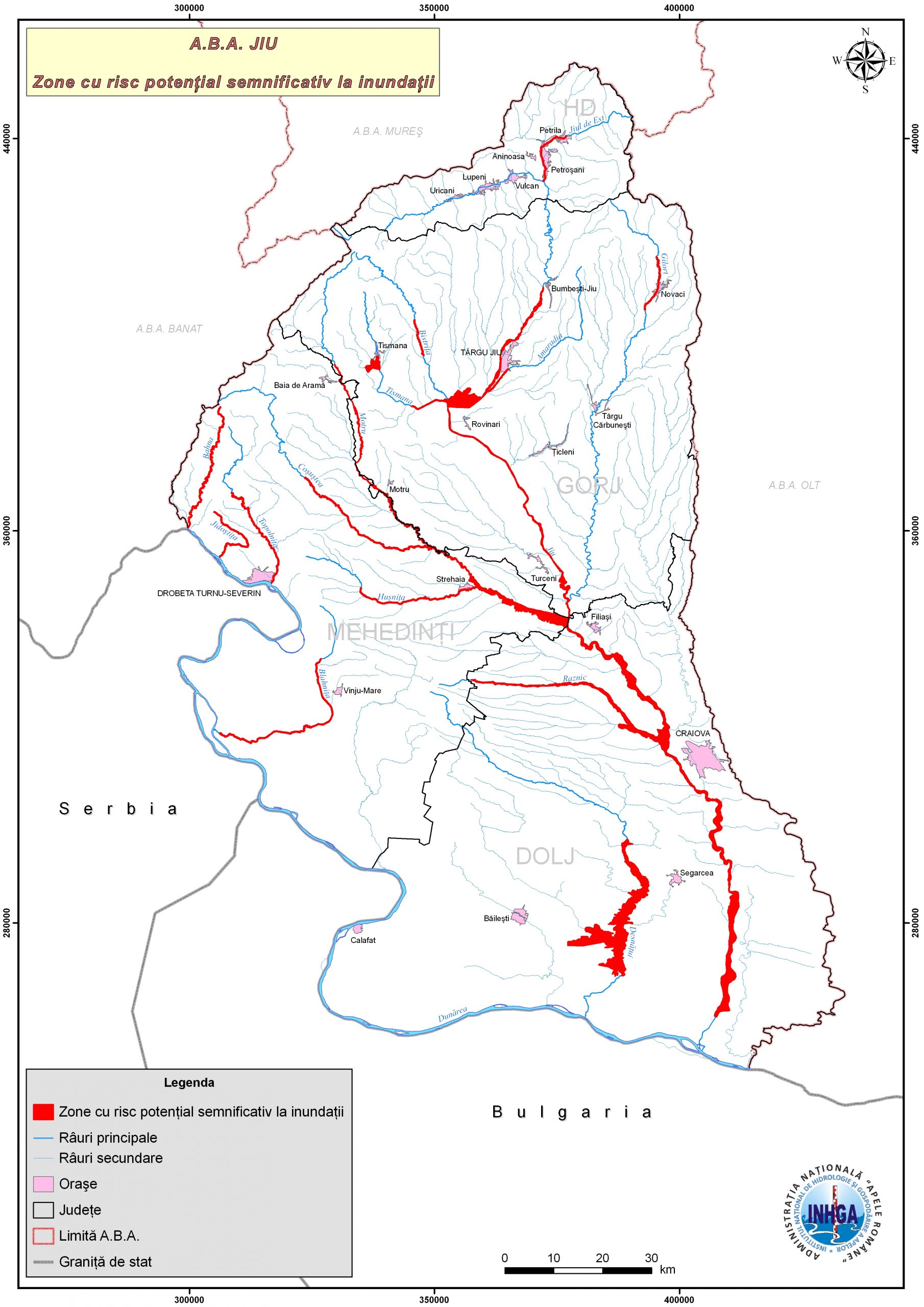
Figure 2. Distribution of APSFR areas by Basin Water Administrations
In accordance with Law nr. 52/2003 on decision-making transparency in public administration, the Ministry of Environment, Waters and Forests with the contribution of the National Administration "Romanian Waters" submits to public debate the document Flood Risk Management Plan – Draft.
Interested citizens and institutions can submit opinions / proposals / suggestions until December 15, 2015, to the Ministry of Environment, Waters and Forests, Directorate for Flood Risk Management and Dam Safety, to the e-mail address: directiainundatii@gmail.com (contact person: Mrs. Simona Olimpia NEGRU – Director of the Flood Risk Management and Dam Safety Department) and at the National Administration "Romanian Waters" at the e-mail address consultare.inundatii@rowater.ro (contact person: Mr. Sorin RINDAŞU – Director of Emergency Situations Department)
The essential problem in flood risk management is that of the risk accepted by the population and decision-makers, knowing that there is no total protection against floods (zero risk), just as there is no general consensus on acceptable risk.
Flood risk is characterized by the nature of the flooding phenomenon (floods from watercourses, flash floods, floods from rising groundwater levels, floods generated by marine storms, exceptional floods generated by accidents / incidents at hydrotechnical constructions – dams, dams) and the probability of occurrence associated with them, correlated with the degree of exposure of receptors (number of people and goods exposed to flood risk as well as their economic value) and vulnerability of receptors to flooding, implicitly resulting that in order to reduce risk, action must be taken on these characteristics of the receptor.
Reducing the consequences of floods is the result of a broad combination of measures and actions prior to the occurrence of the phenomenon ( prevention, protection and preparation), flood management (response actions taken during floods, known as emergency management) and post-flood management (reconstruction and lessons learned as a result of the phenomenon).
In accordance with European legislation and international literature, flood risk management means applying policies, procedures and practices aimed at Risk identification, analysis And Assessment their treatment, monitoring And Revaluation risks in order to reduce them, so that human communities, all citizens, can live, work and meet their needs and aspirations in a sustainable physical and social environment.
As required Directive on flood risk assessment and management, by 22 December 2015, all Member States are required to develop Flood Risk Management Plans (with reference to C.E. – March 22, 2016), for all identified areas with potentially significant flood risk, covered by Article 5 of the Directive (reported to the EC in March 2012), for which, moreover, flood hazard and risk maps have been drawn up in accordance with Article 6 of the Directive (maps reported to the EC in March 2014).
Flood Risk Management Plans shall be coordinated at river basin level (Management Unit), in accordance with Article 3.2(b) (Articles 7.1 and 4, Article 8), respectively – in the case of Romania – at the level of Basin Water Administrations.
To this end, Member States shall set flood risk management objectives , focusing on reducing the potential negative effects of floods on human health, economic activity, the environment and cultural heritage. We mention that the Flood Risk Management Plans will contribute, at the same time, to achieving the objectives set by the National Strategy for Flood Risk Management in the medium and long term (approved by H.G. 846/2010).
The programme of measures in a basin shall be based on structural and non-structural measures. Structural measures have the role of protection, prevention and mitigation of flood effects and are applied in order to reduce the peak flow of floods, the maximum levels in the riverbed, the duration of the flood, defending the assets and population of the major riverbed. Their realization / implementation usually involves a long period and requires an extensive analysis from several points of view (technical, economic, environmental, social criteria, etc.).
At European level, structural measures are no longer necessarily considered to be the best solution for flood management. In this respect, there is an increasing emphasis on non-structural measures and green infrastructure solutions, which are becoming increasingly important with the increasing recognition of its benefits. Thus, natural flood management measures are recommended, measures aimed at increasing temporary storage capacities for flood water and, at the same time, can provide ecosystem services. The concept developed at C.E. level is called
Natural Water Retention Measures, which are support measures for green infrastructure.
According to the literature, non-structural measures are classified into two broad categories: measures to reduce the likelihood of flooding (hazard reduction) and measures to increase flood resilience.
An example of measures to reduce hazard are afforestation measures, terracing of vineyards with orchards or vines, practicing agricultural works perpendicular to the slope of the land, works to combat torrents and soil erosion, measures to avoid new constructions in the floodplain, etc. As measures to increase resilience, we mention measures to increase community awareness, measures regarding flood forecasting, measures regarding the management of emergency situations and last but not least, measures to regulate constructions currently in floodplains: measuresto consolidate/cant the house, measures to waterproof its structure, etc.
The measures that can be taken are complex and require the involvement of several institutions, local, county, basin authorities, several “actors”, of which, the most important is the population itself.
Flood Risk Management Plans will support decision-making and contribute to increasing awareness and understanding of flood risk, especially in areas of potentially significant flood risk. They will be developed and published on the websites of the National Administration “Romanian Waters”, of the Basin Water Administrations (A.B.A.) and of the National Institute of Hydrology and Water Management (I.N.H.G.A.) until December 22, 2015 and then reported to the European Commission by March 22, 2016.
Comparison
content FLOOD RISK MANAGEMENT PLAN elaborated at A.B.A. level
Versus
content FLOOD RISK MANAGEMENT PLAN according to the provisions of the Floods Directive
|
CONTENT OF THE FLOOD RISK MANAGEMENT PLAN |
|
|
Requirements according to Directive 2007/60/EC (Annex) |
P.M.R.I. / A.B.A. requirements according to the I.N.H.G.A. Methodology (chapter enumeration) |
Watershed overview
Soil; biodiversity; Population, human settlements; Land use; Economic activity; Infrastructure; Recreation and tourism; Cultural heritage |
|
|
Flood risk at A.B.A. level
|
|
Requirements according to Directive 2007/60/EC (Annex) |
P.M.R.I. / A.B.A. requirements according to the I.N.H.G.A. Methodology (chapter enumeration) |
|
Description of flood risk management objectives |
|
Summary of proposed measures and their prioritization
|
|
Description of the methodology for prioritizing flood risk management measures based on Multi-Criterial Analysis |
|
Description of how progress in implementing measures will be monitored |
|
Public information and consultation |
|
List of competent authorities in the implementation and monitoring / evaluation of P.M.R.I. |
| Description of the coordination process in the international D.B.H.; | |
| Description of the coordination process with the D.C.A. (Directive 2000/60/EC). | |
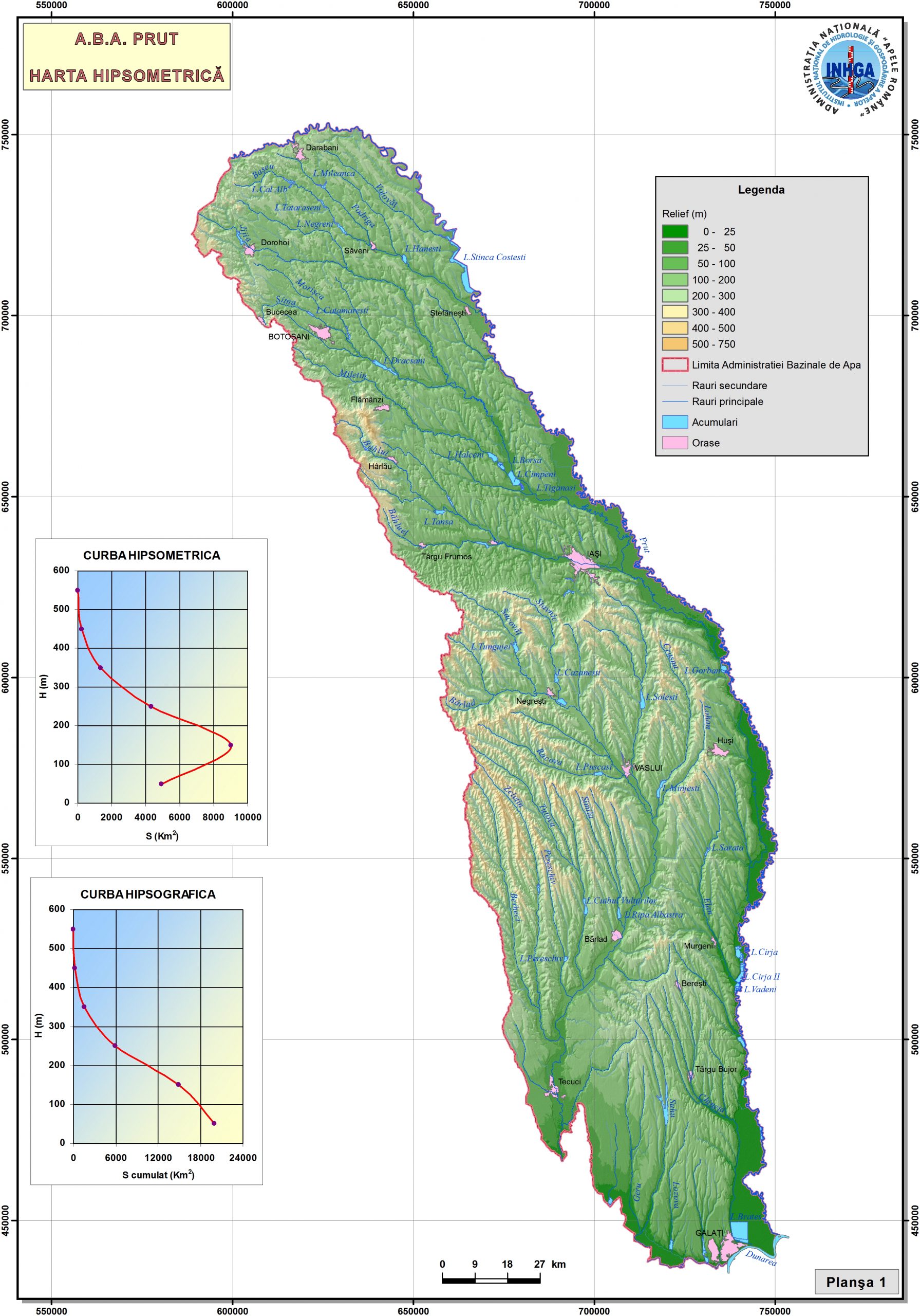
Prut

The Flood Risk Management Plans were approved by Government Decision nr. 972 of 21 December 2016 and published in the Official Gazette no. 106 of 7 February 2017
On 16 December 2015 the ICPDR (International Commission for the Protection of the Danube River) published in Vienna the first Flood Risk Management Plan for the Danube Basin.
This, together with the Danube River Basin Management Plan, sets priorities for the Danube basin until 2021.
The Flood Risk Management Plan is a milestone in ICPDR's work towards sustainable flood risk management. It addresses all aspects of flood risk management focusing on prevention, protection and preparedness, including measures to achieve the objectives set, and calling for solidarity among all ICPDR contracting parties.
This management plan has been developed with the involvement of stakeholders and the public. For the next six years, the ICPDR's work will be geared towards its implementation and the measures contained therein.
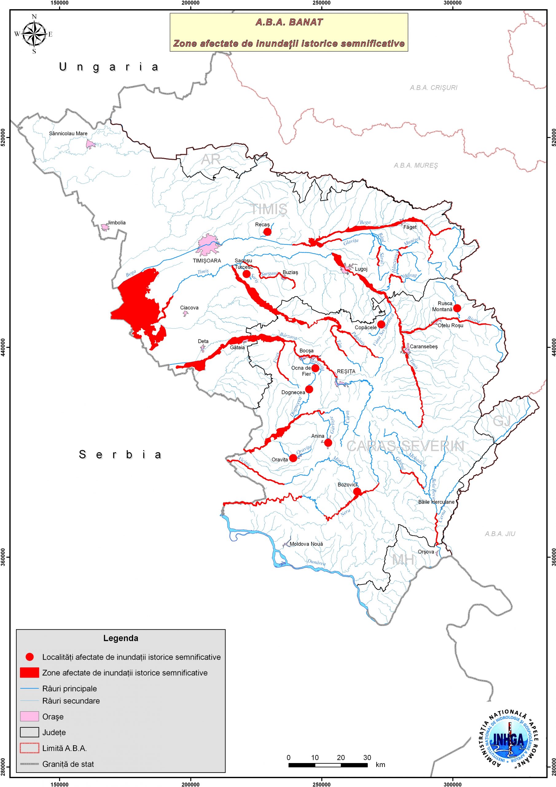
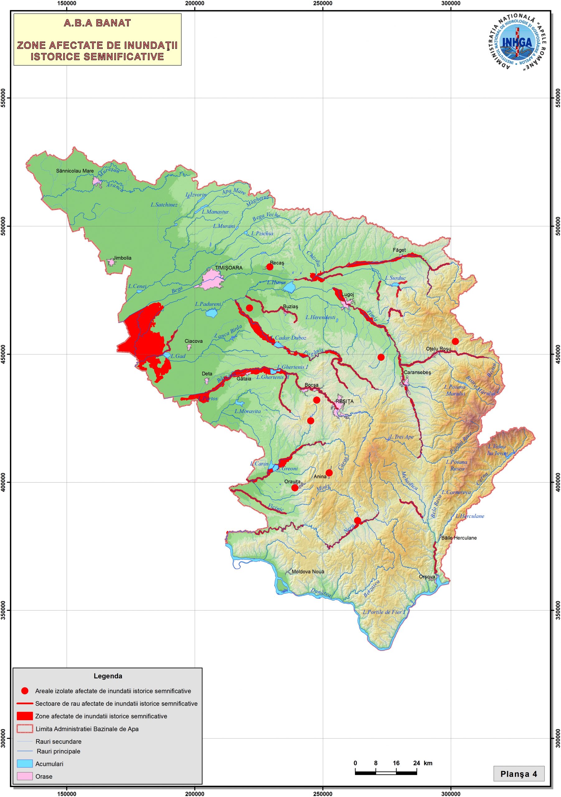
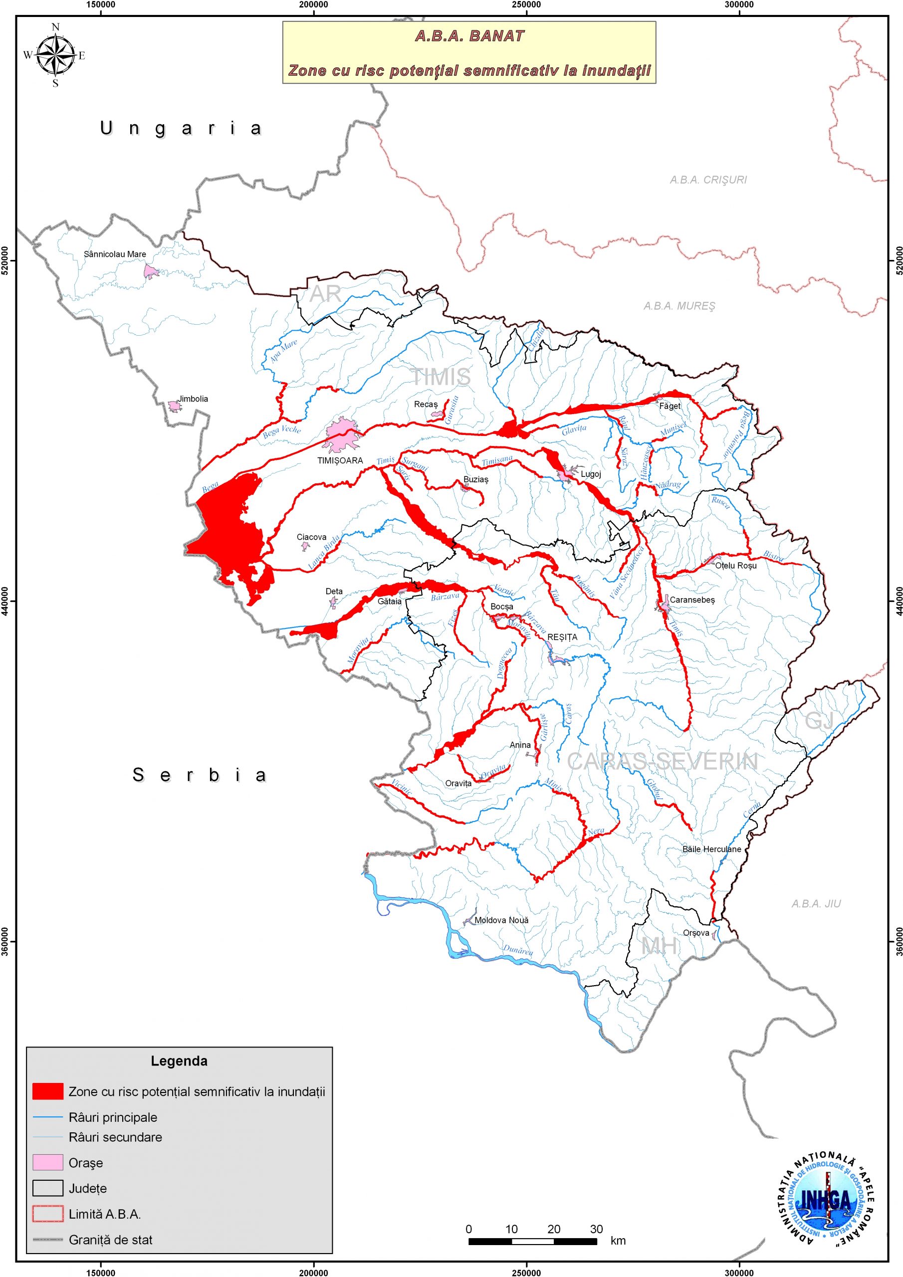
- 01-Historical-significant-floods-hydrographic-basins-ABA-Banat
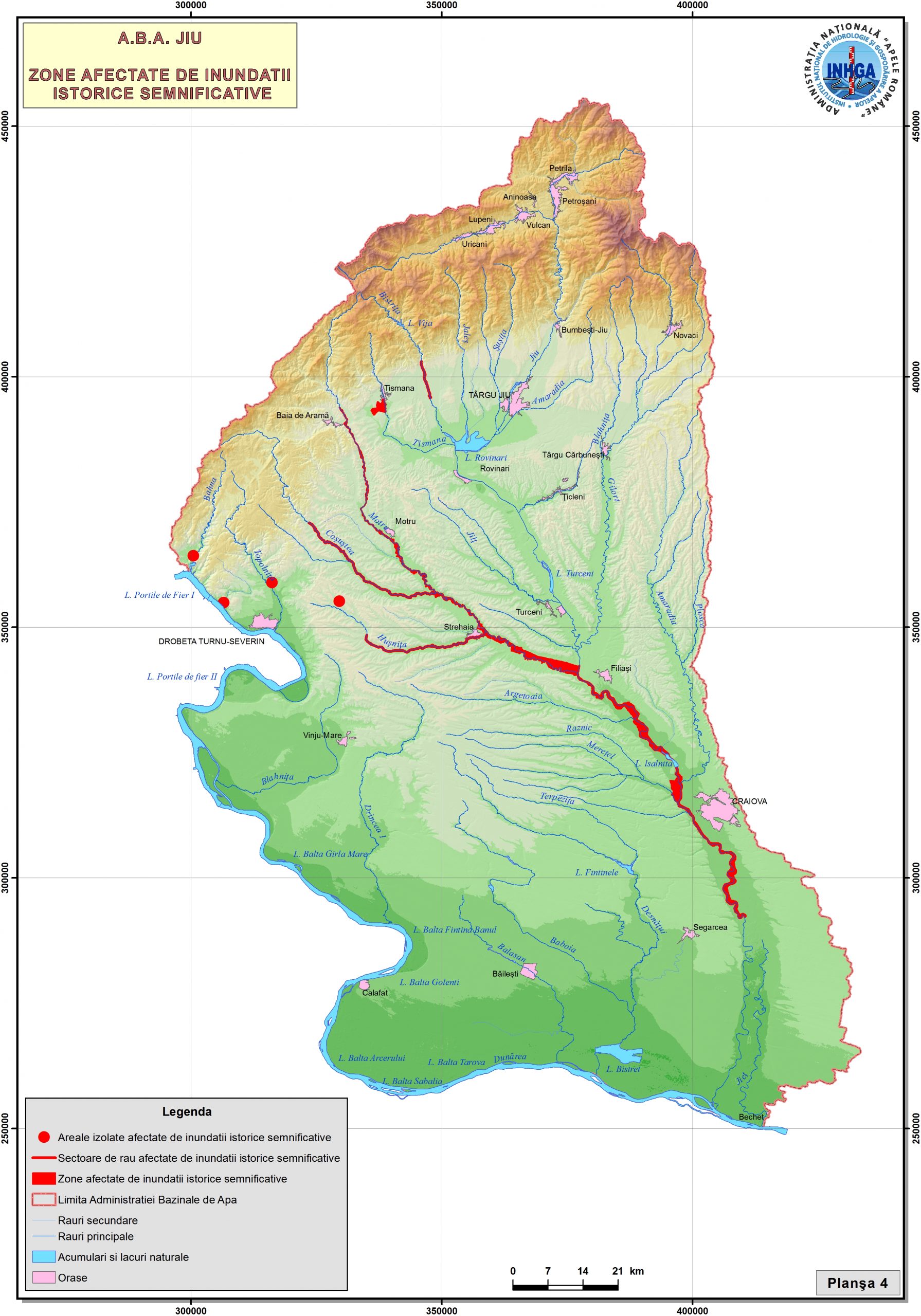
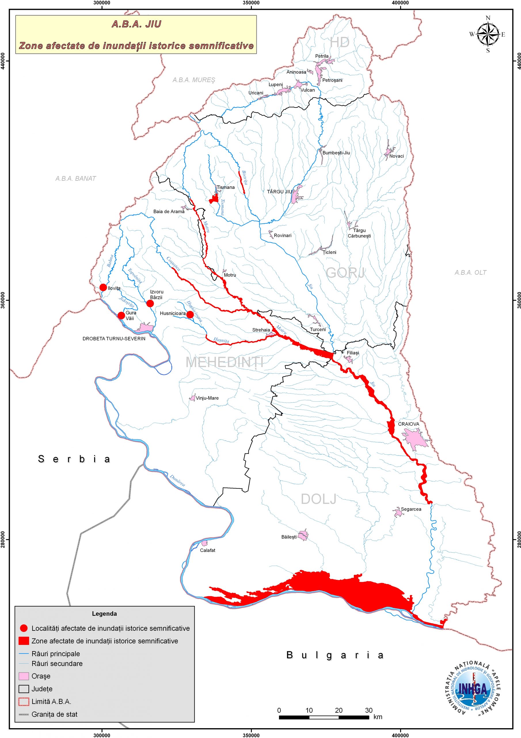
- 02-Flood-historical-significant-watershed-ABA-Jiu
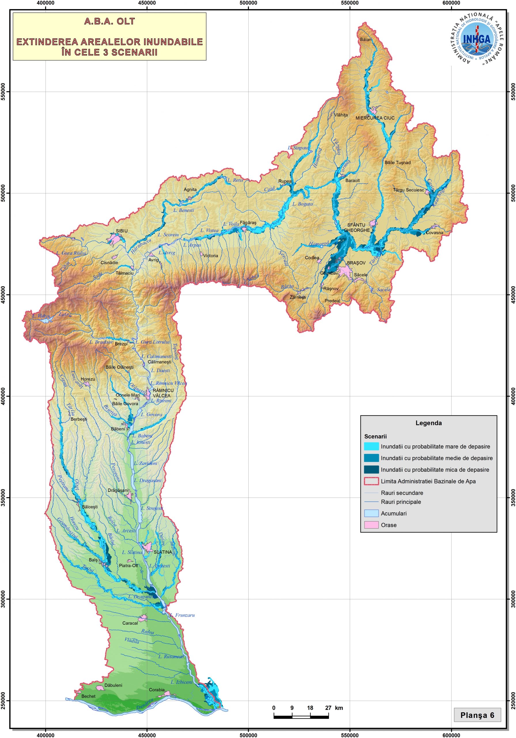
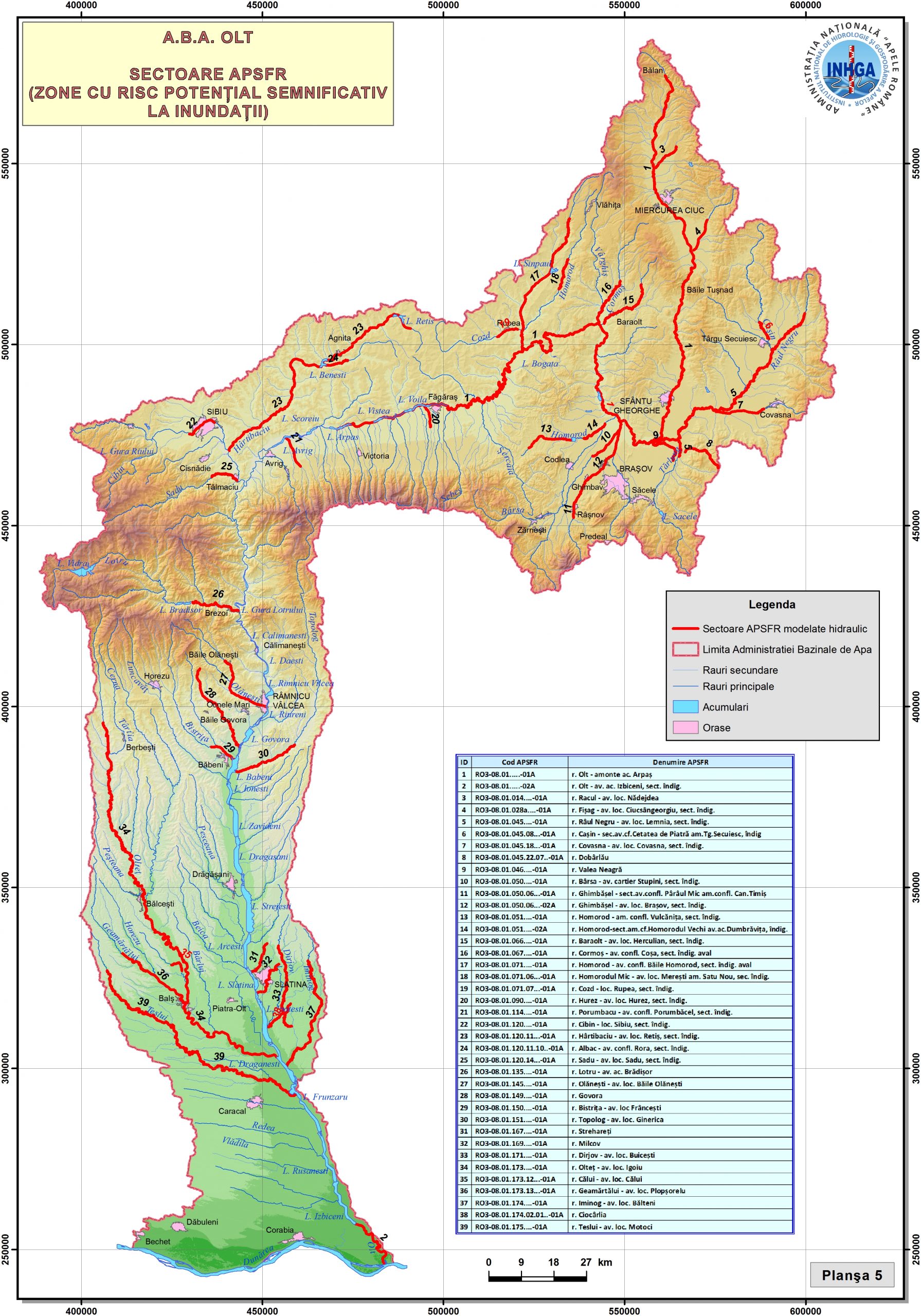
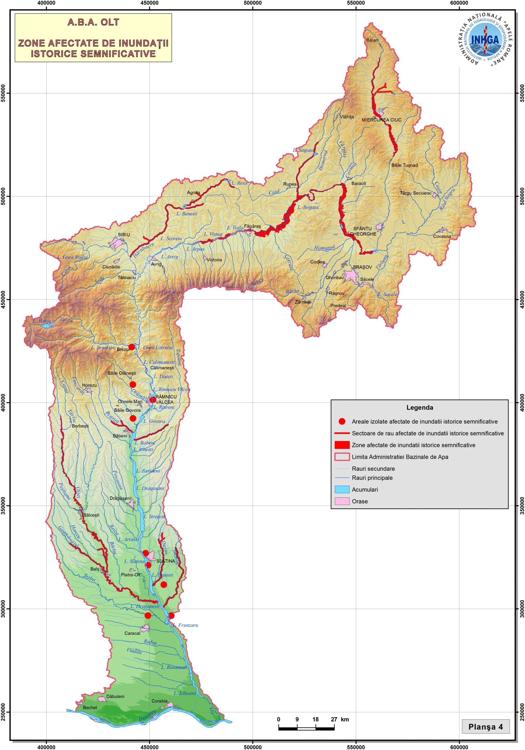
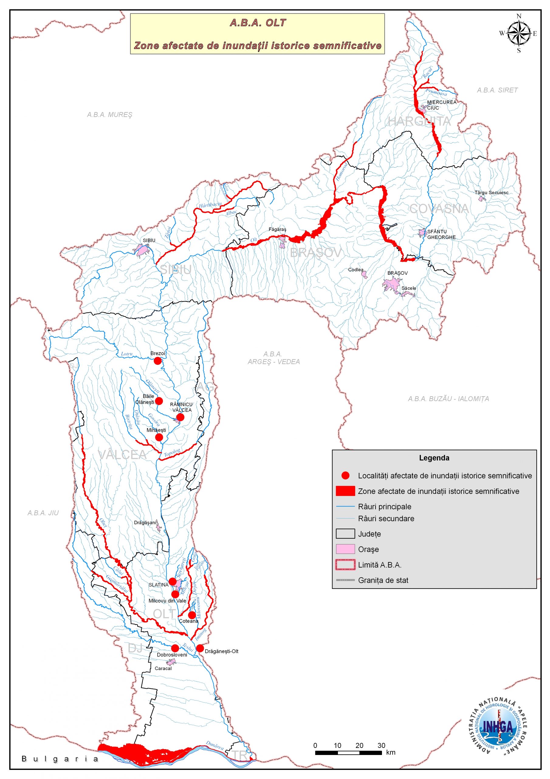
- 03-Floods-historical-significant-hydrographic-basins-ABA-Olt
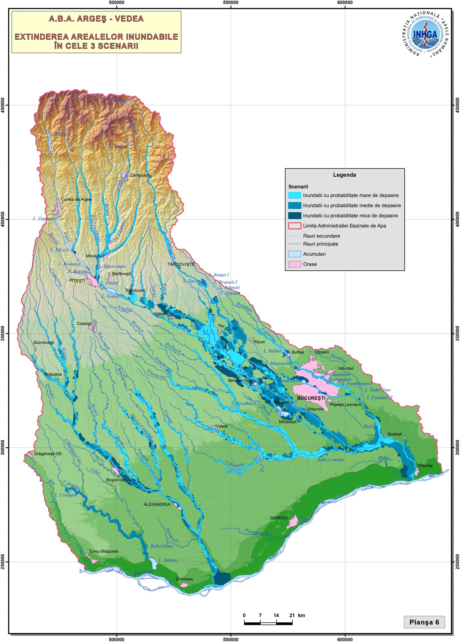
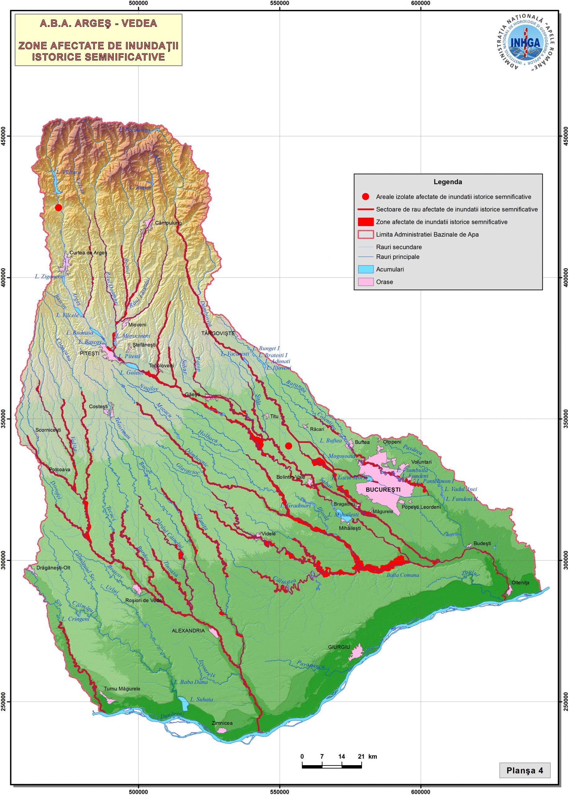
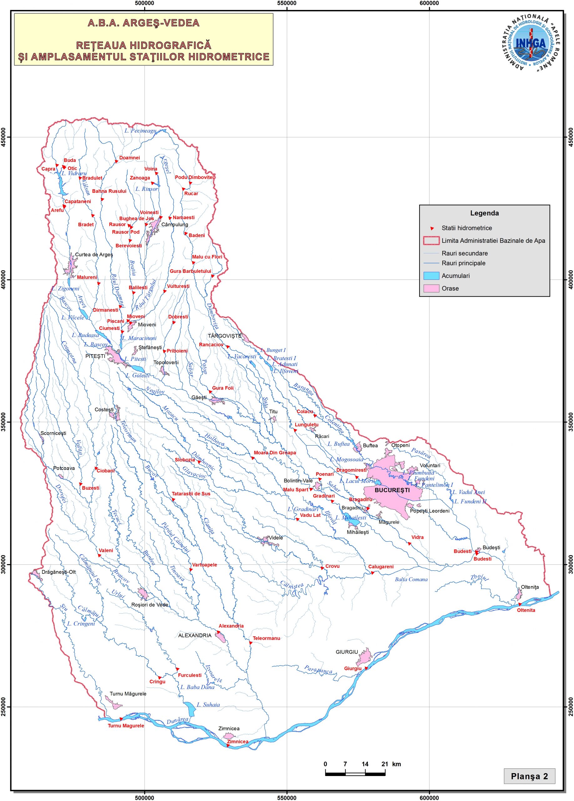
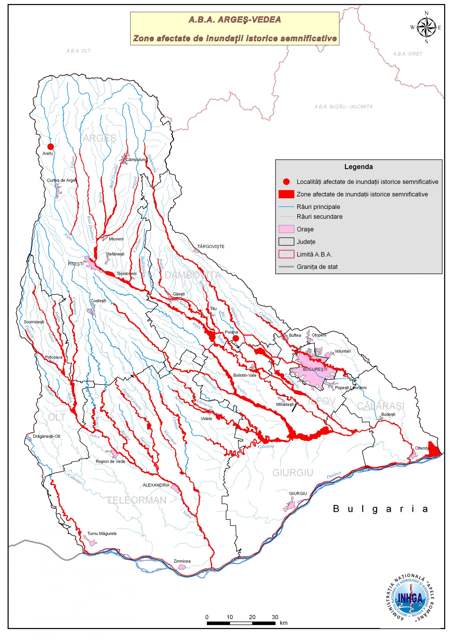
- 04-Floods-historical-significant-hydrographic-basins-ABA-Arges-Vedea
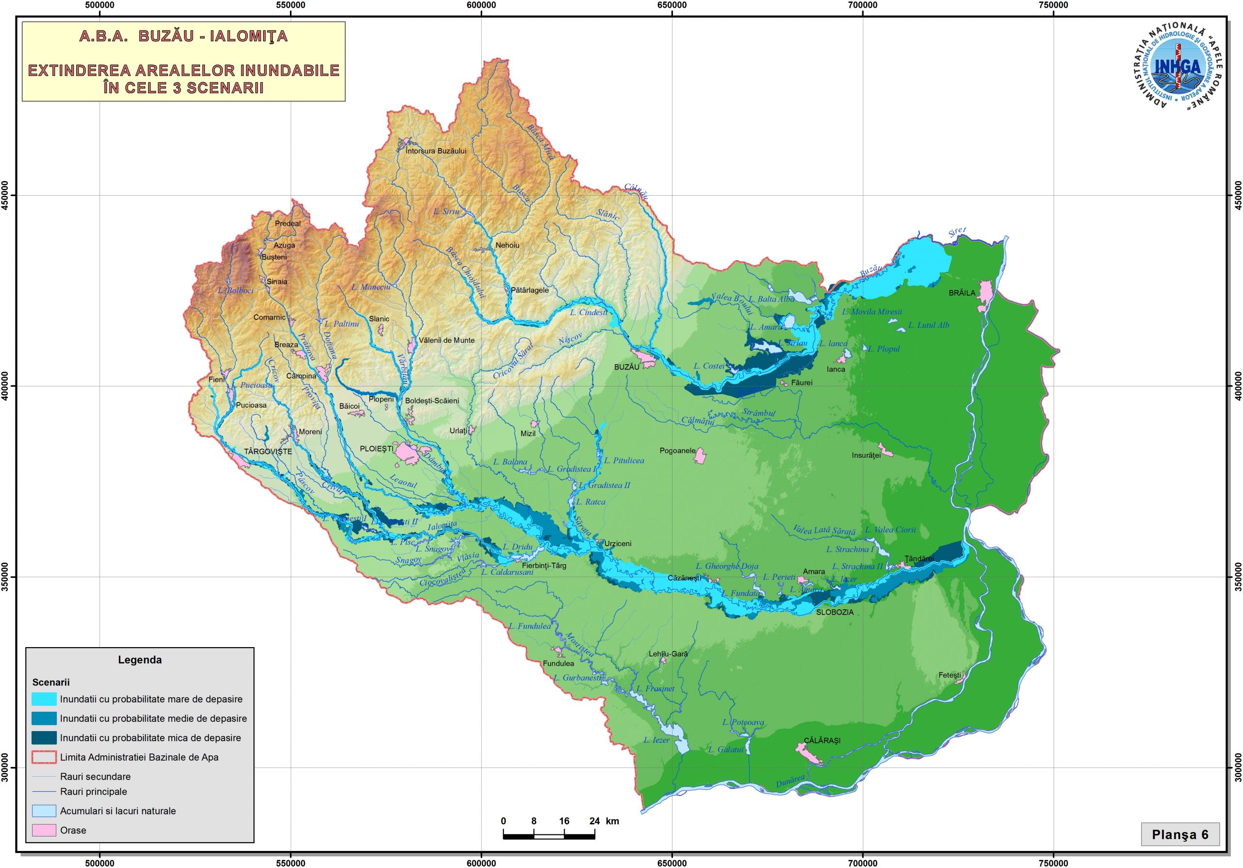
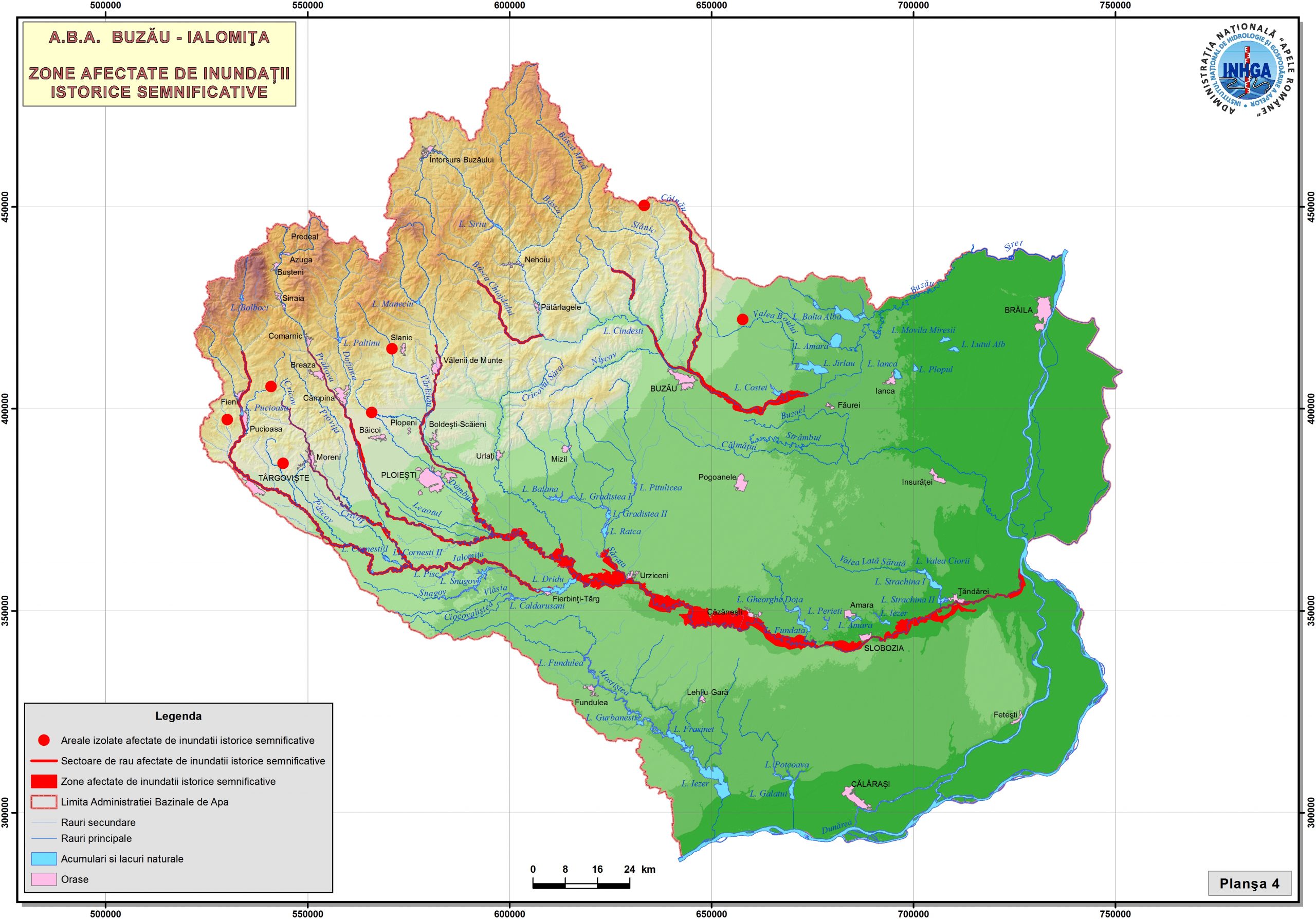
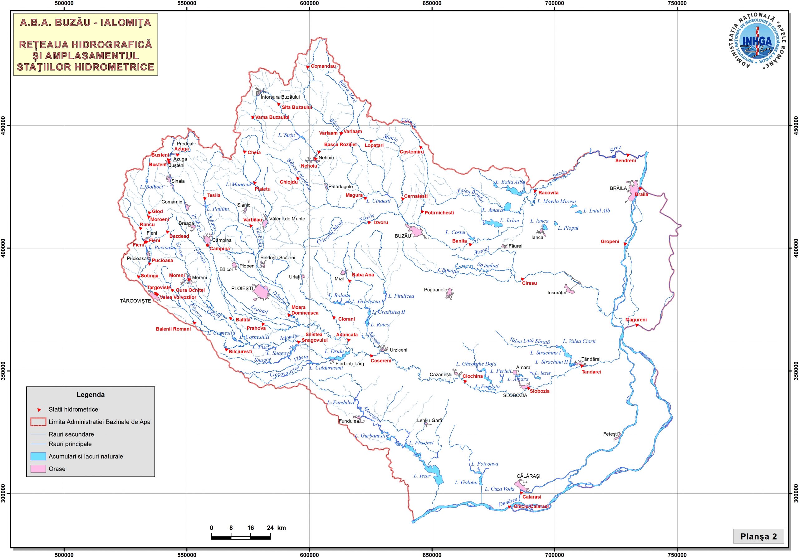
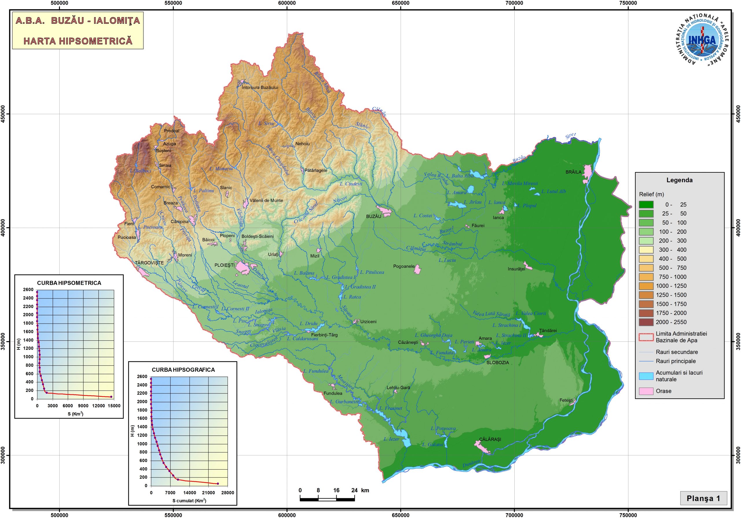
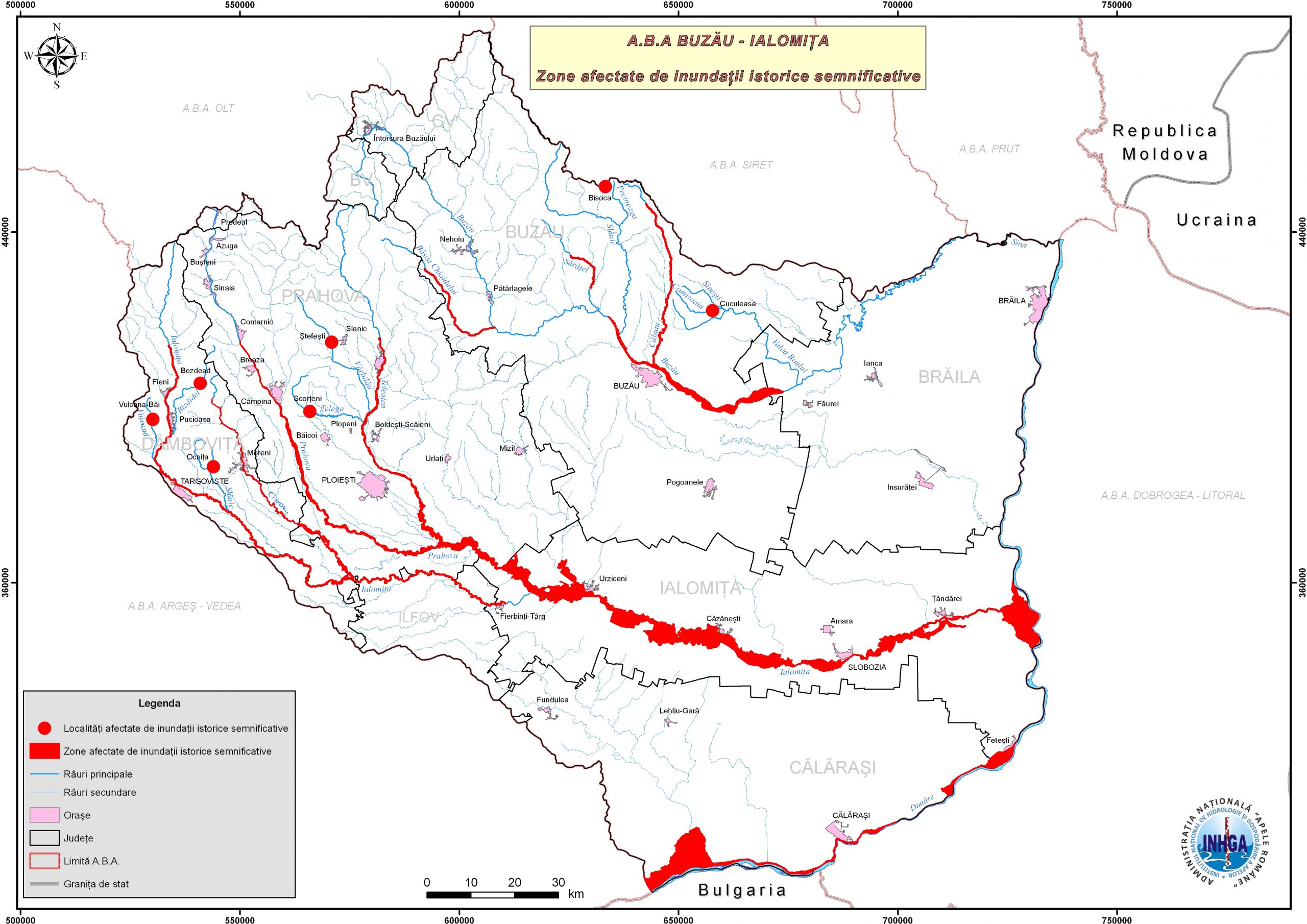
- 05-Historical-significant-floods-hydrographic-basins-ABA-Buzau-Ialomita
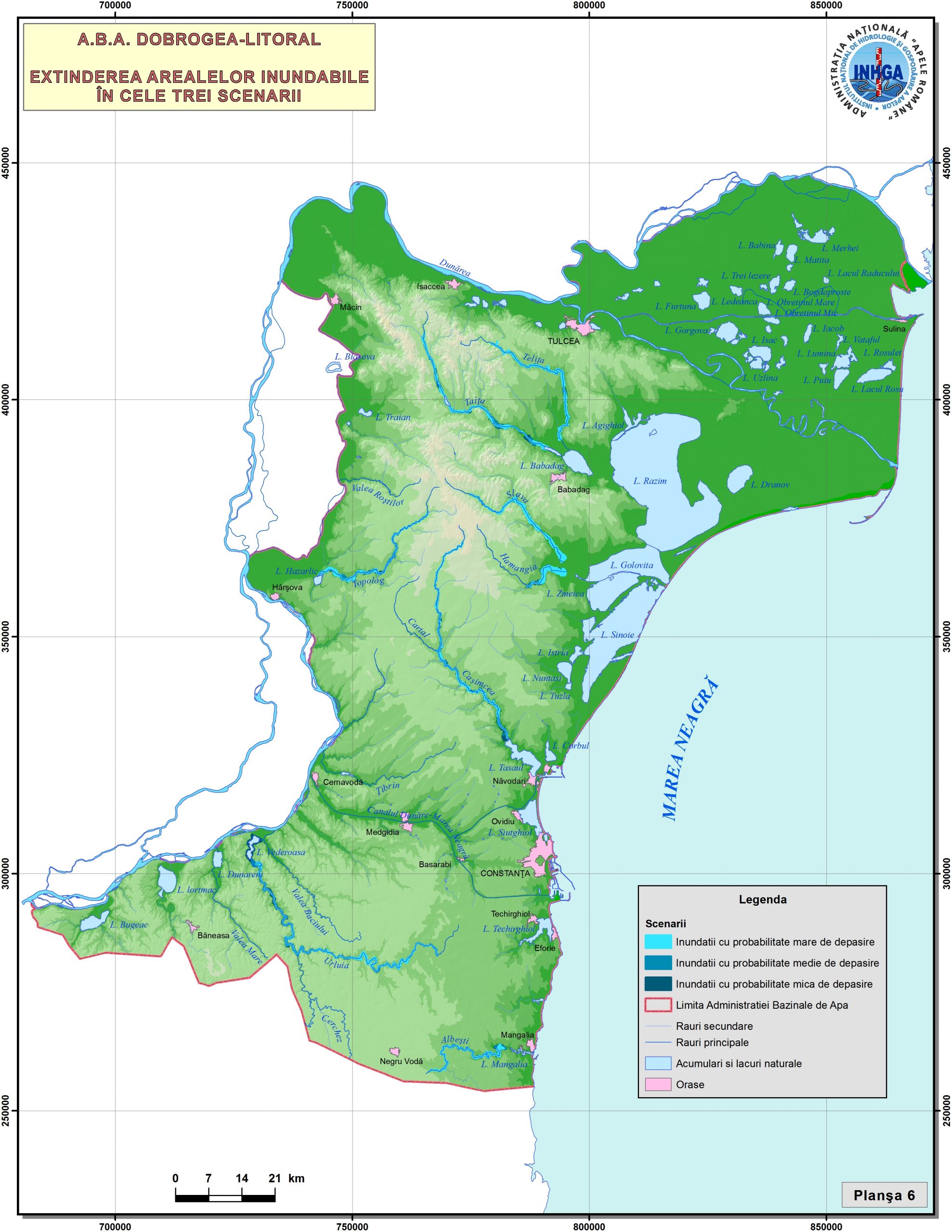
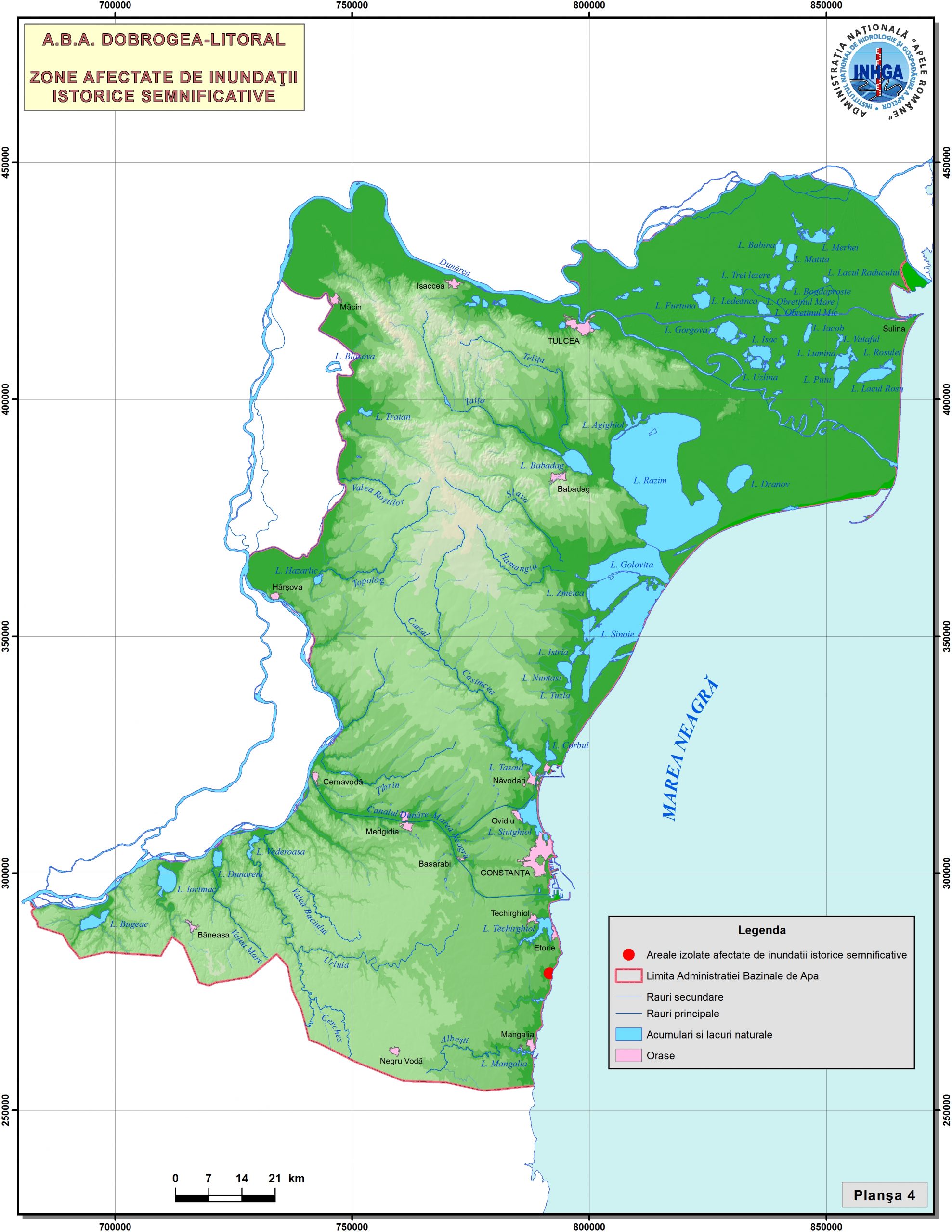
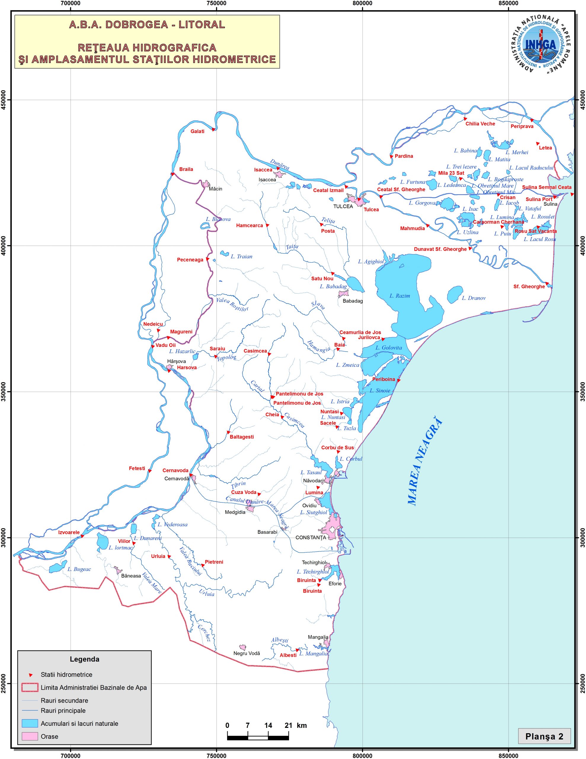
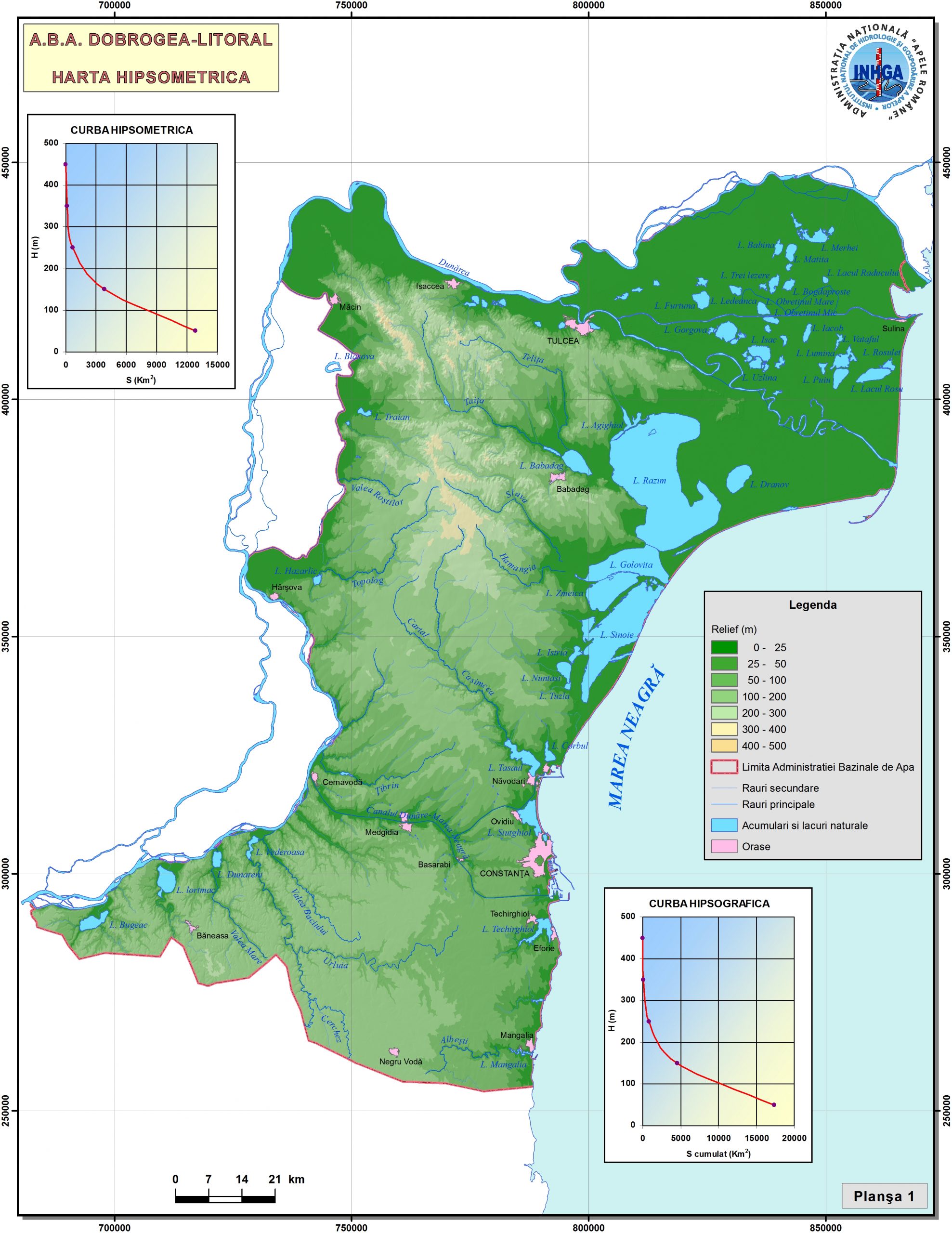
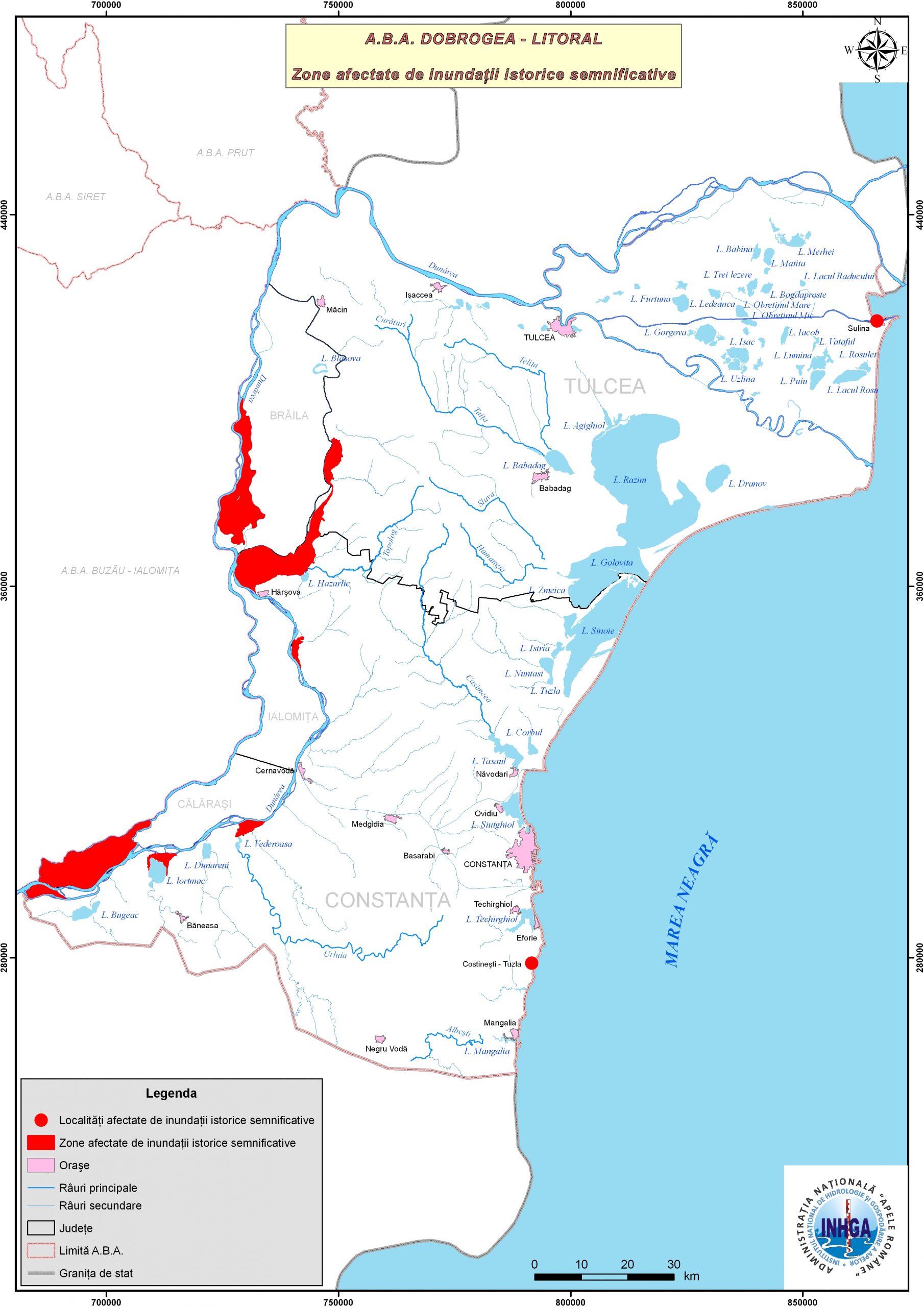
- 06-Historical-significant-floods-hydrographic-basins-ABA-Dobrogea-Seaside
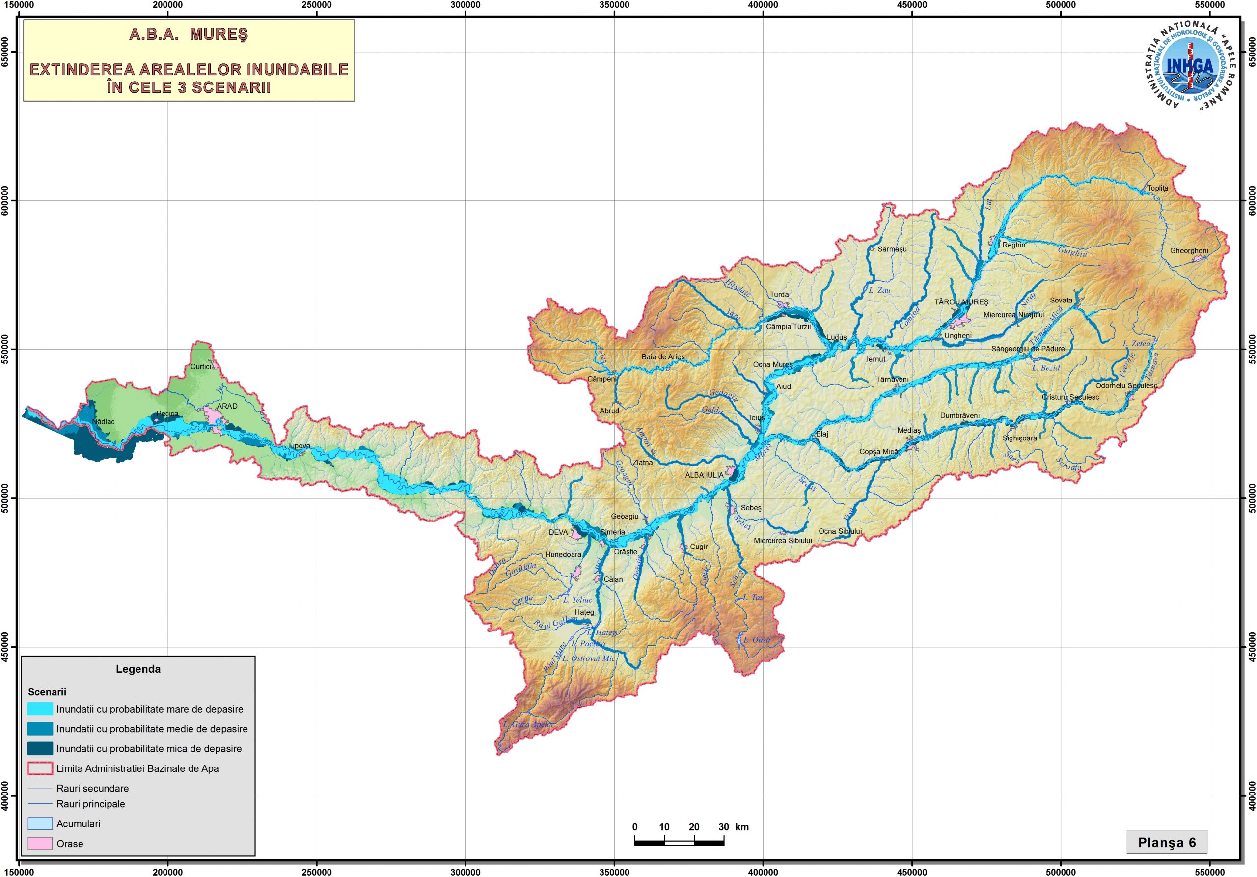
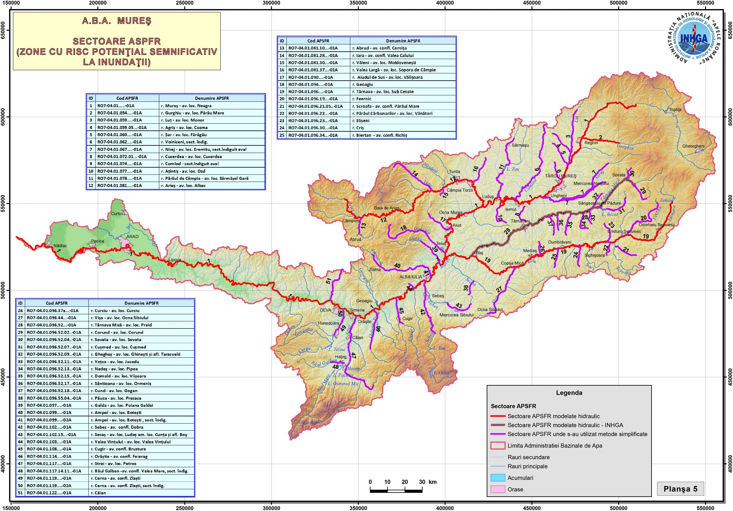
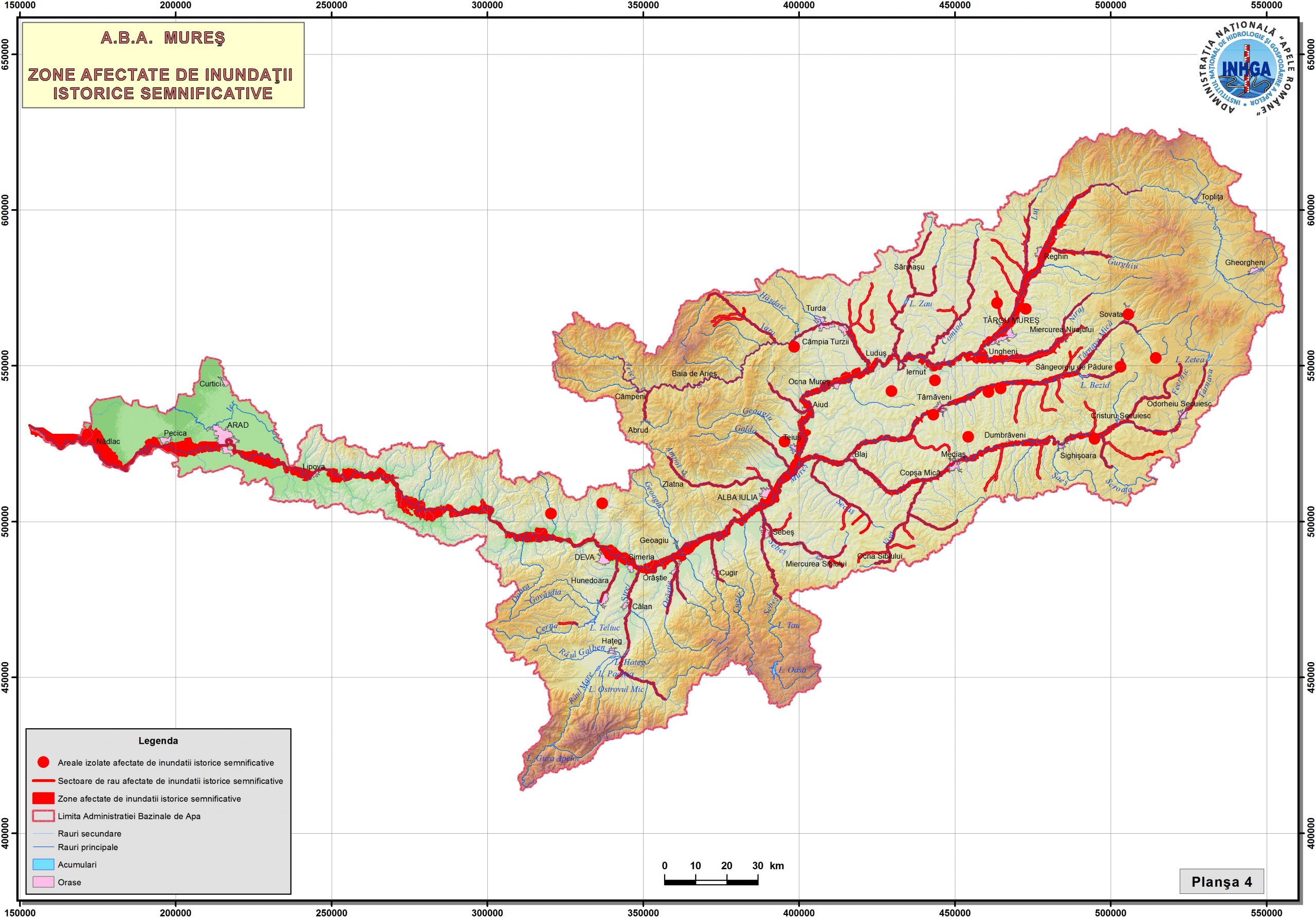
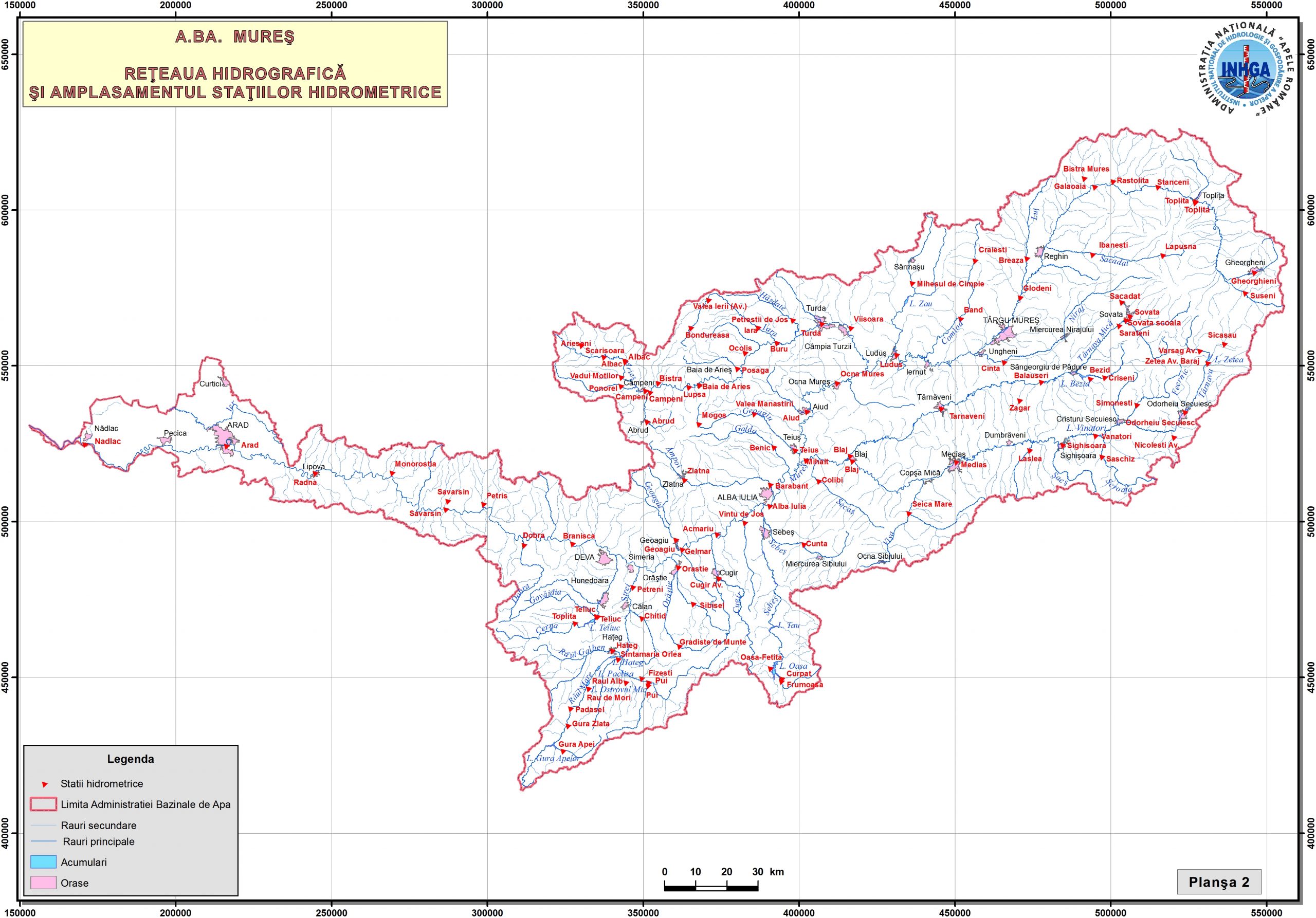
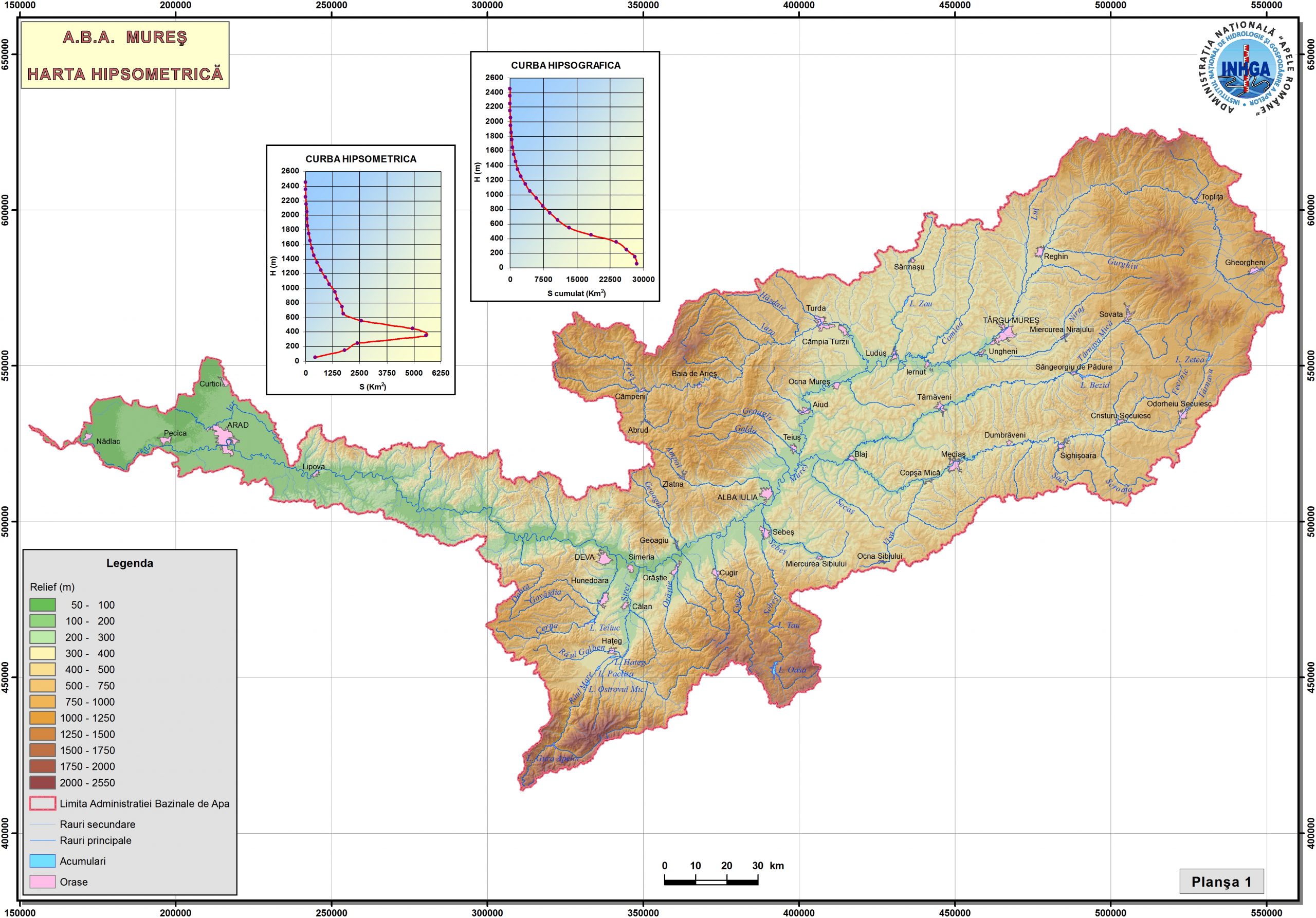
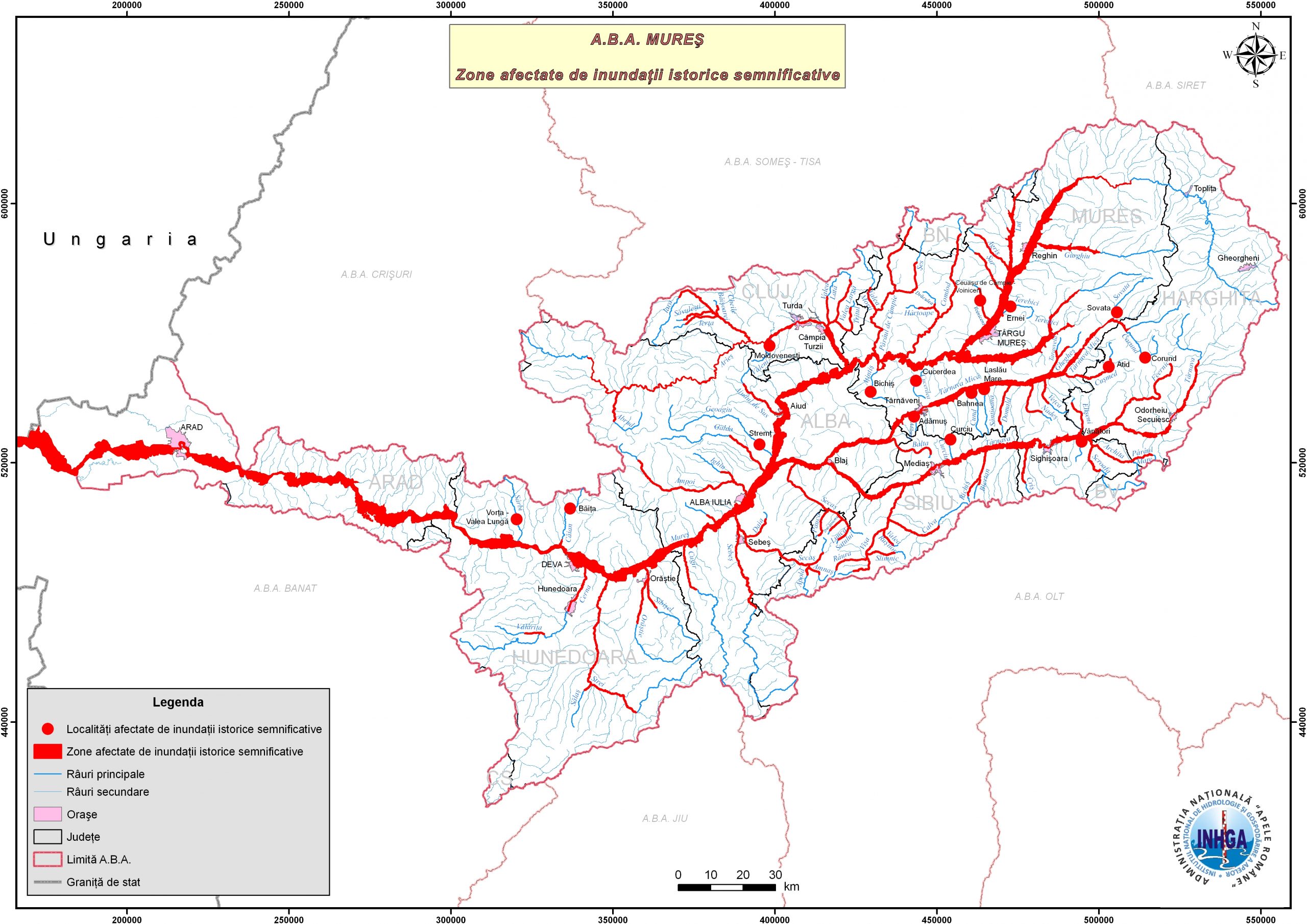
- 07-Historical-significant-floods-hydrographic-basins-ABA-Mures
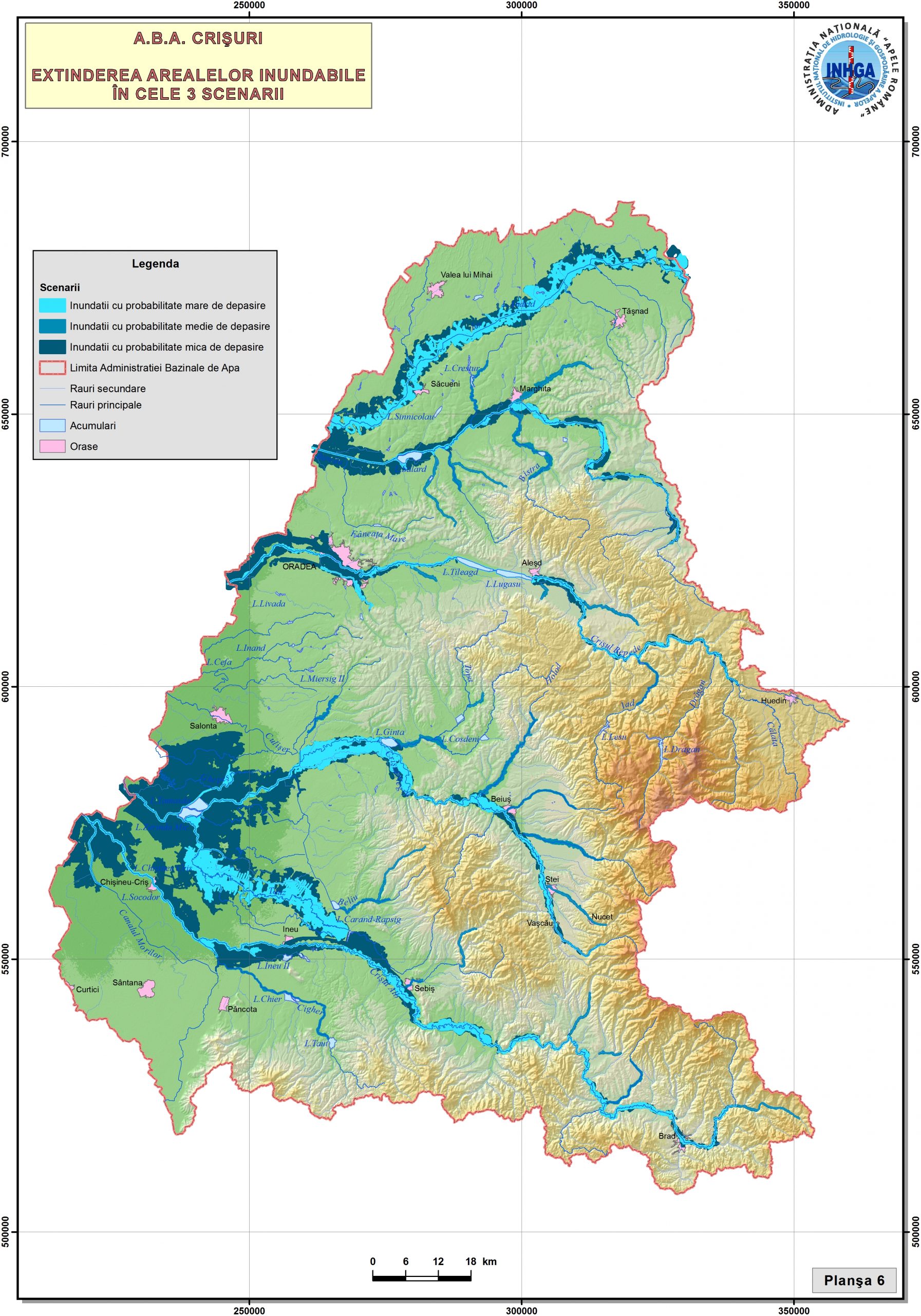
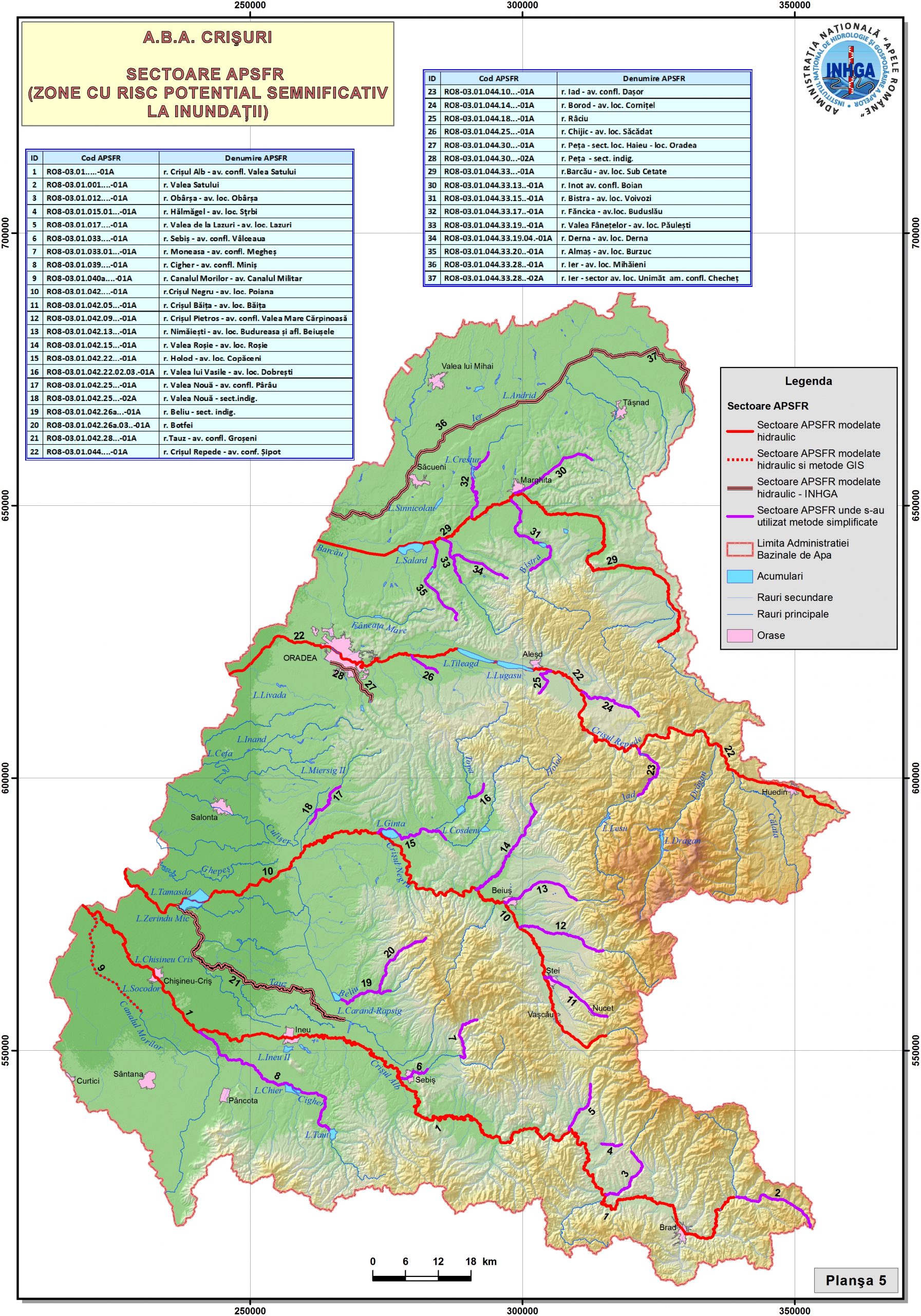
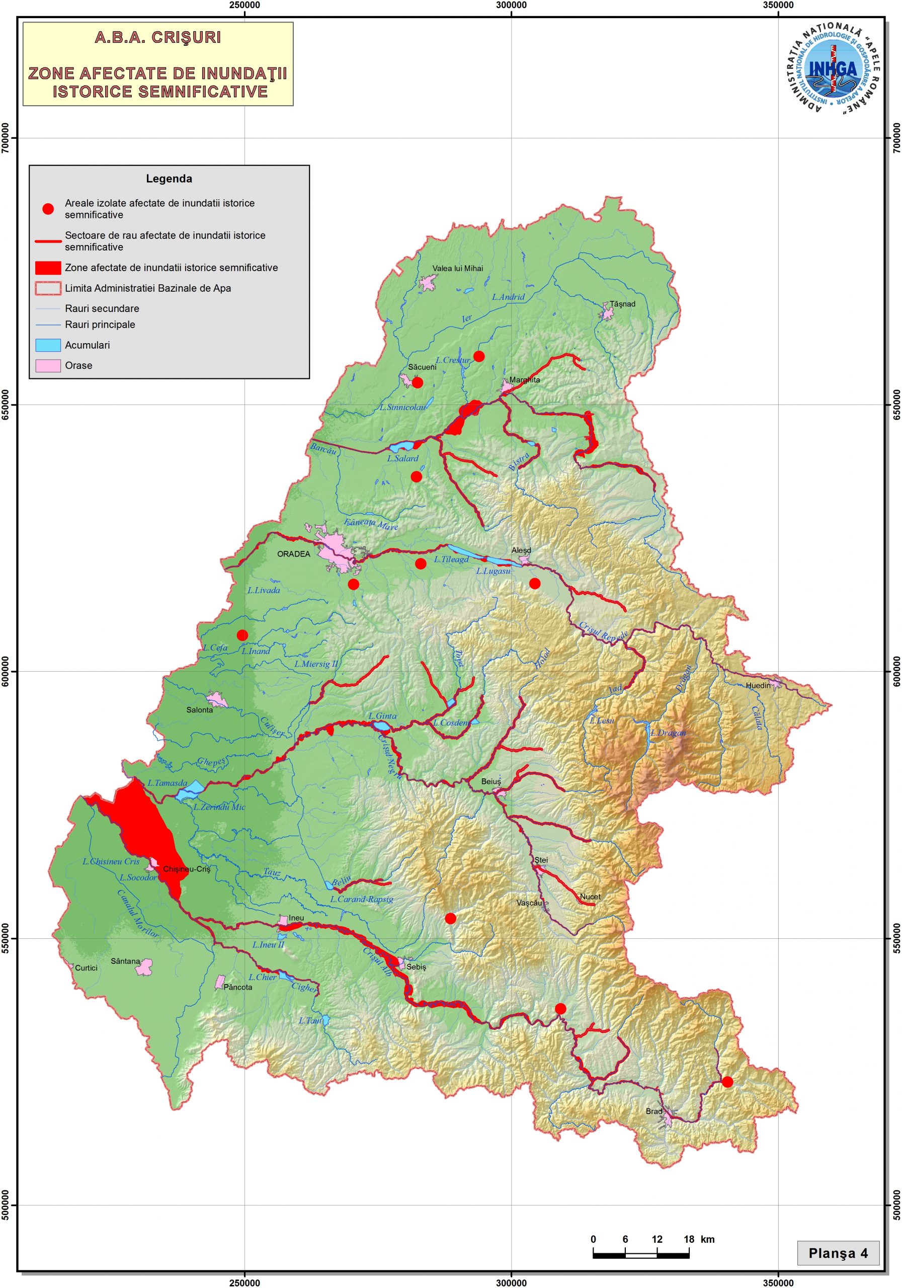
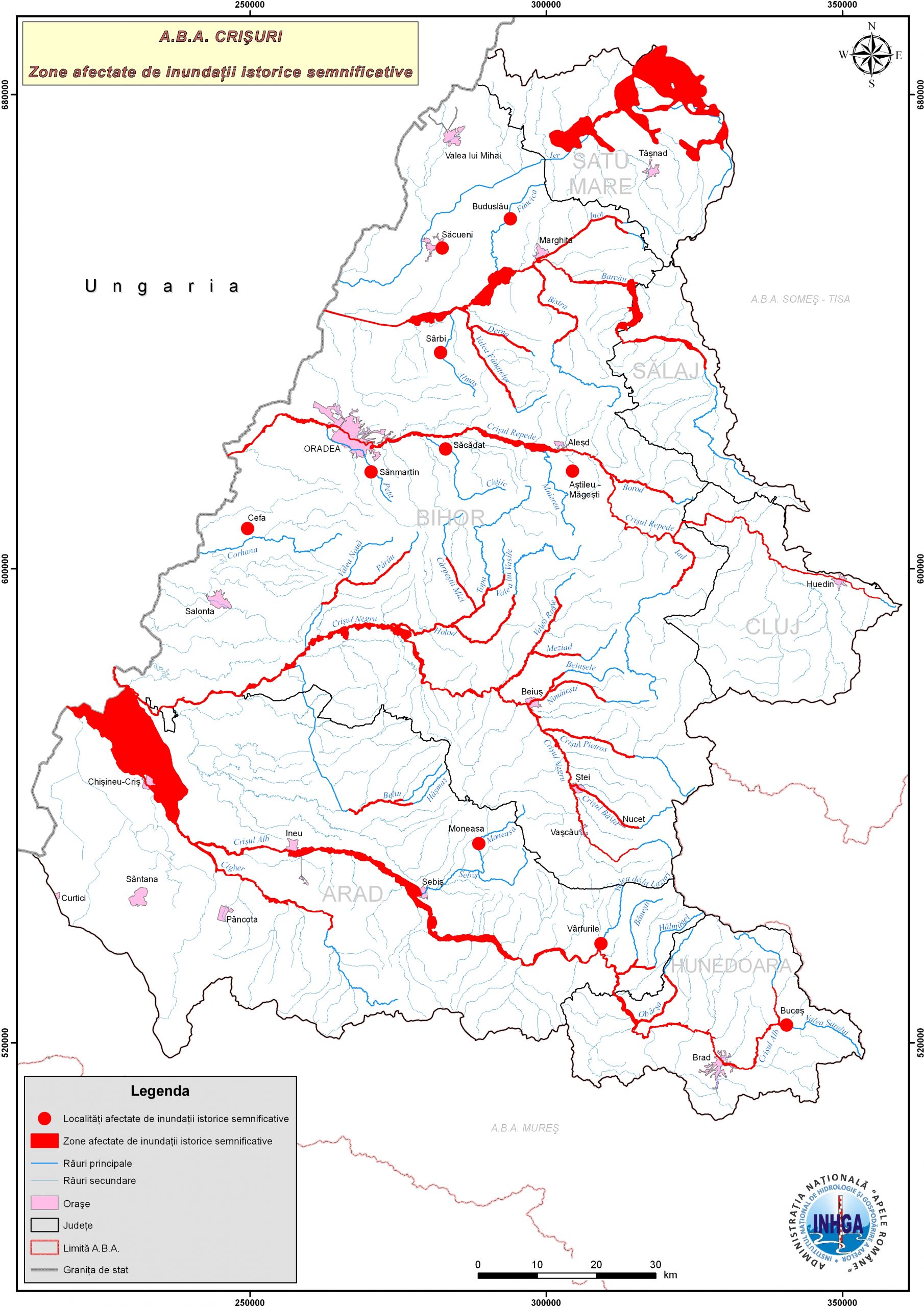
- 08-Historical-significant-floods-hydrographic-basins-ABA-Crisuri
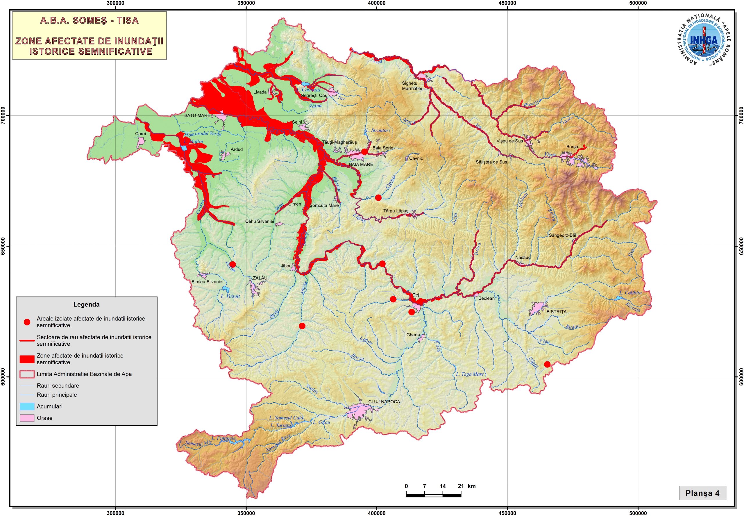
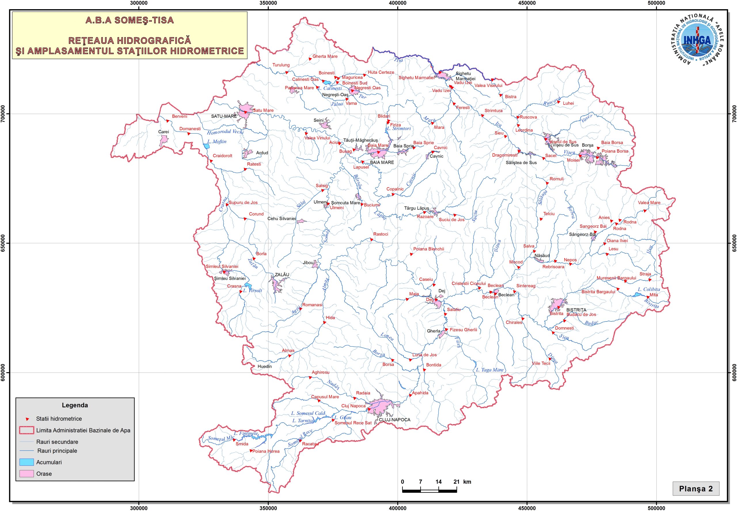
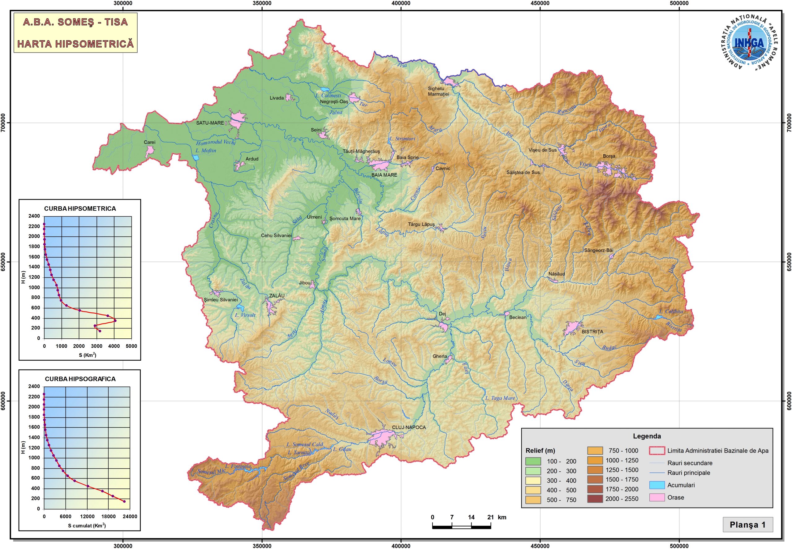
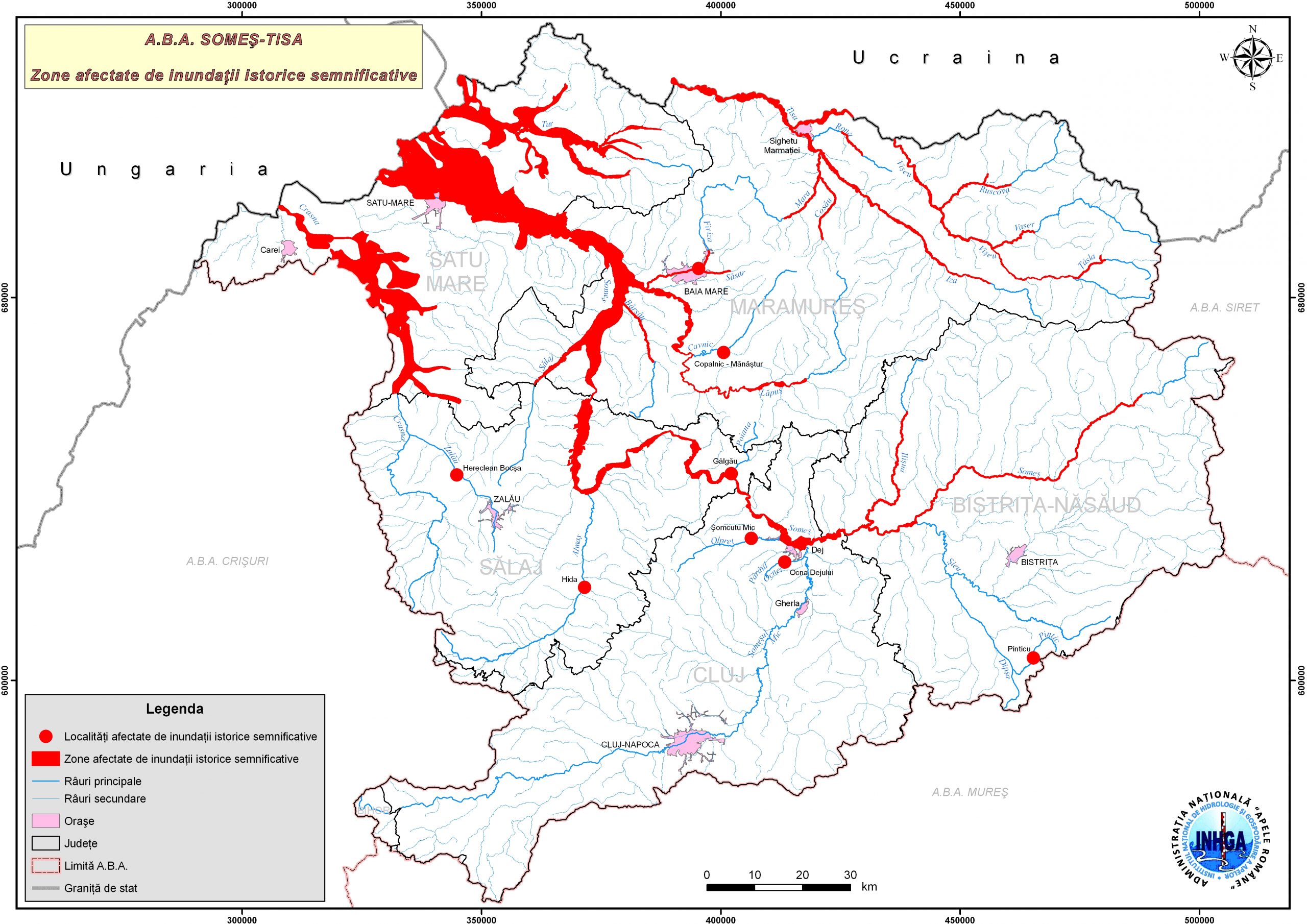
- 09-Historical-significant-floods-hydrographic-basins-ABA-Somes-Tisa
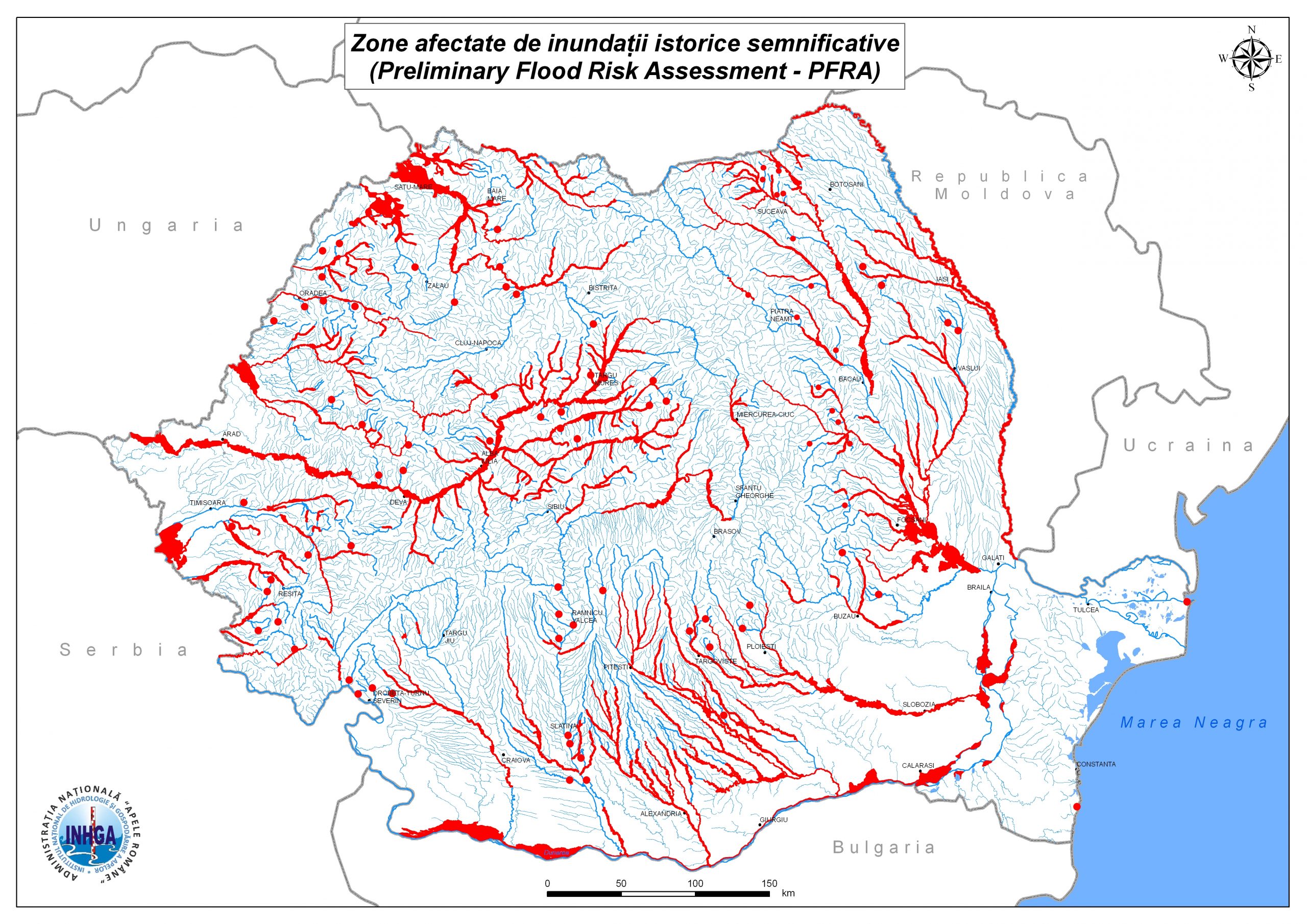
- 1000-Historical-significant-floods-watersheds-Danube-Basin
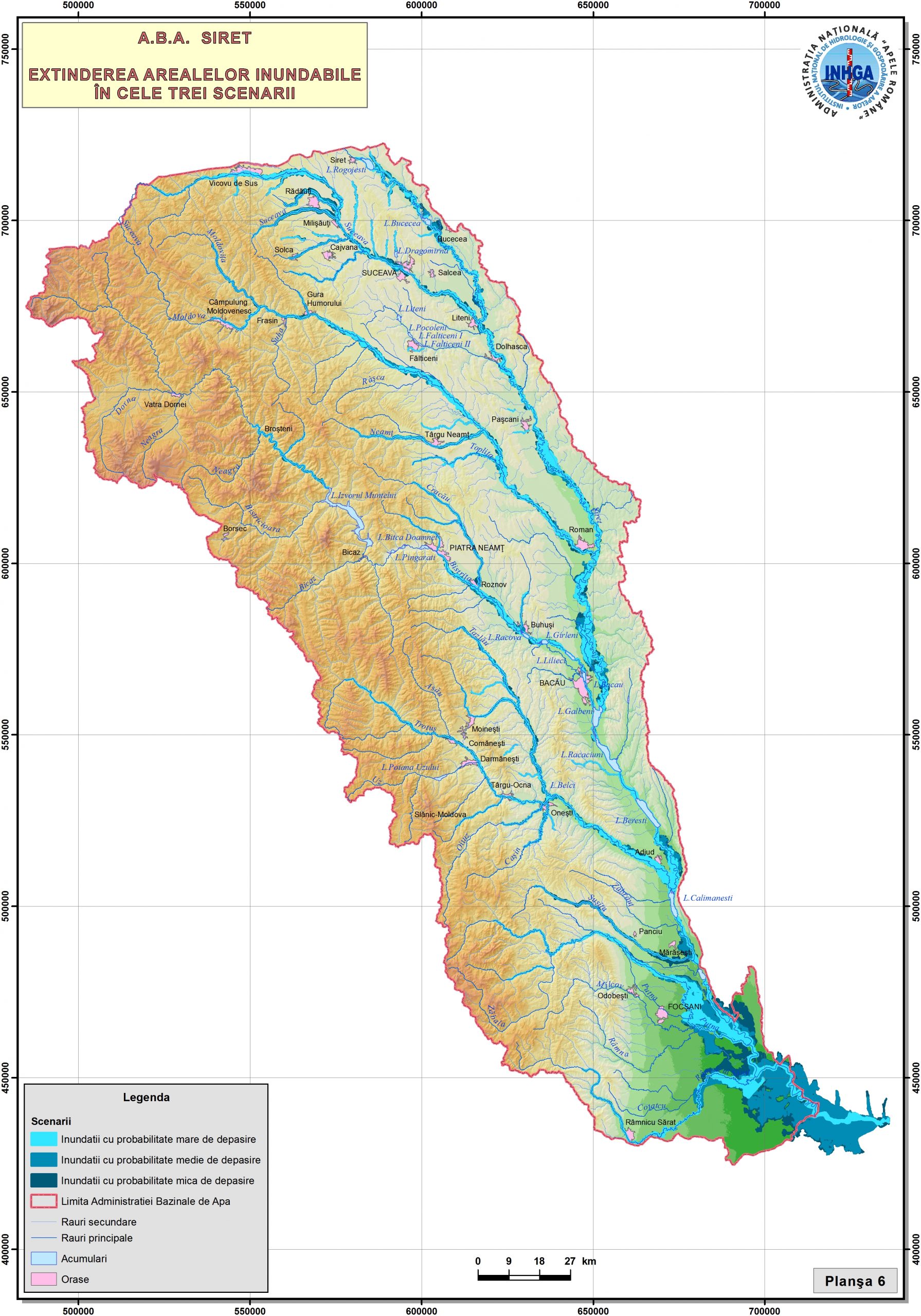
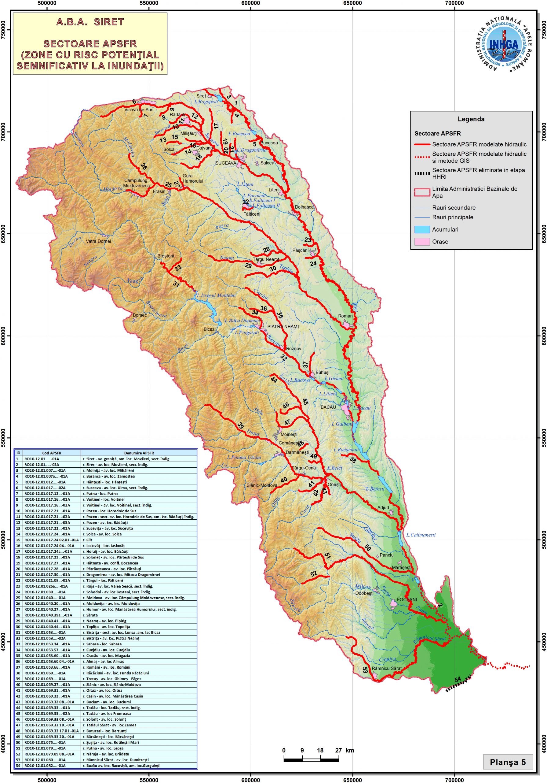
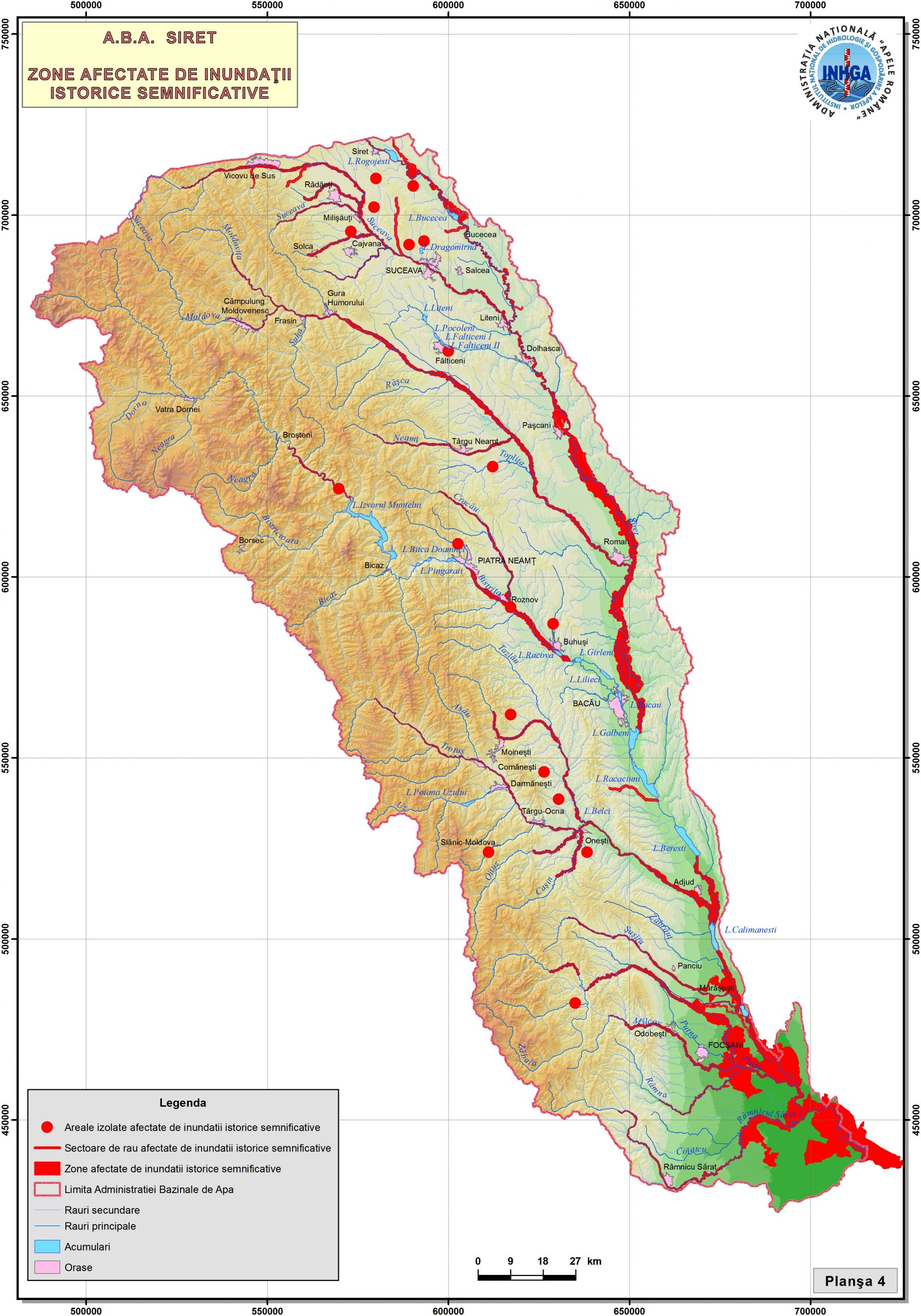
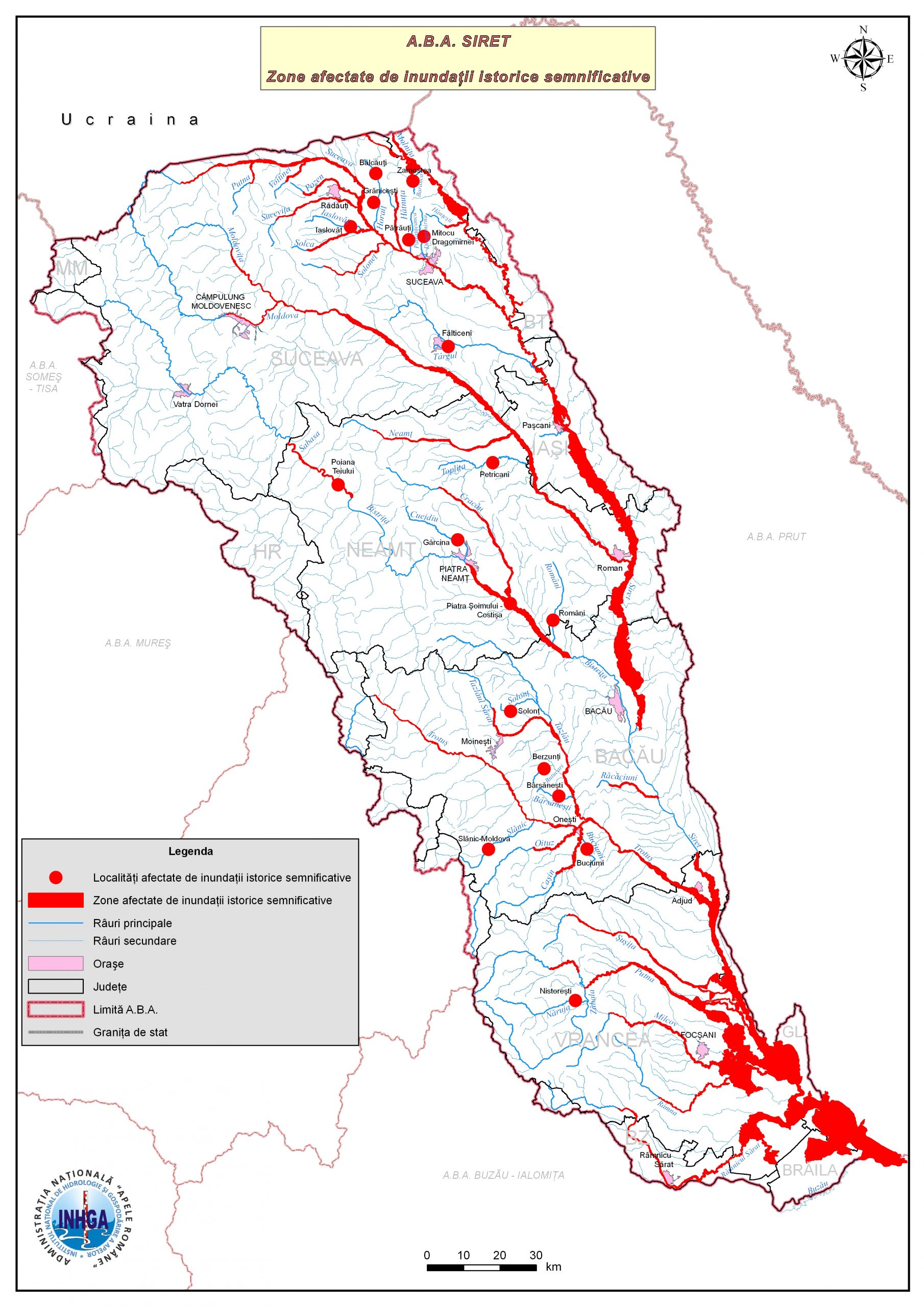
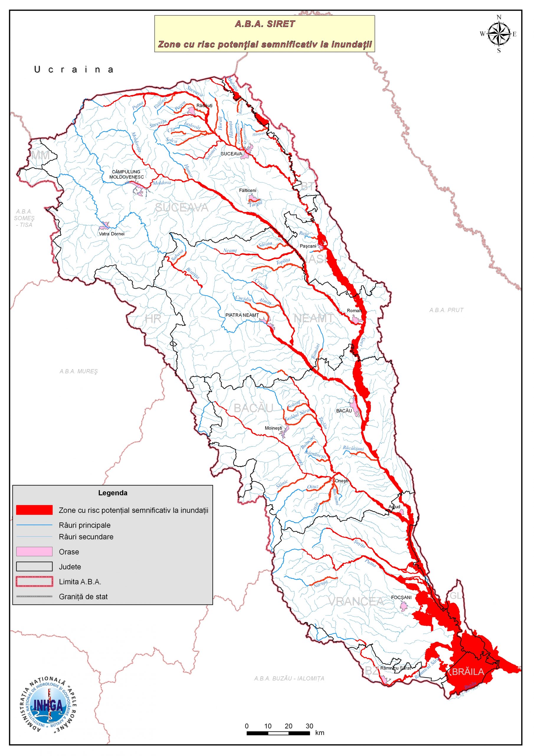
- 11-Floods-historical-significant-river basins-ABA-Siret
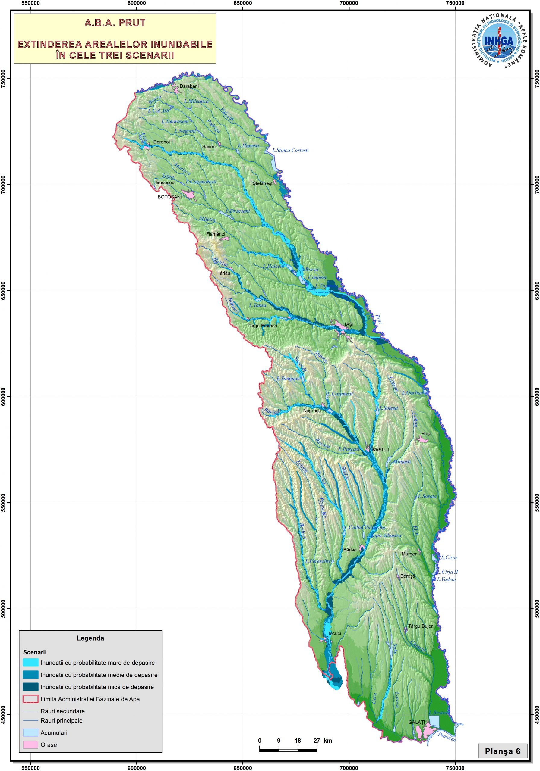
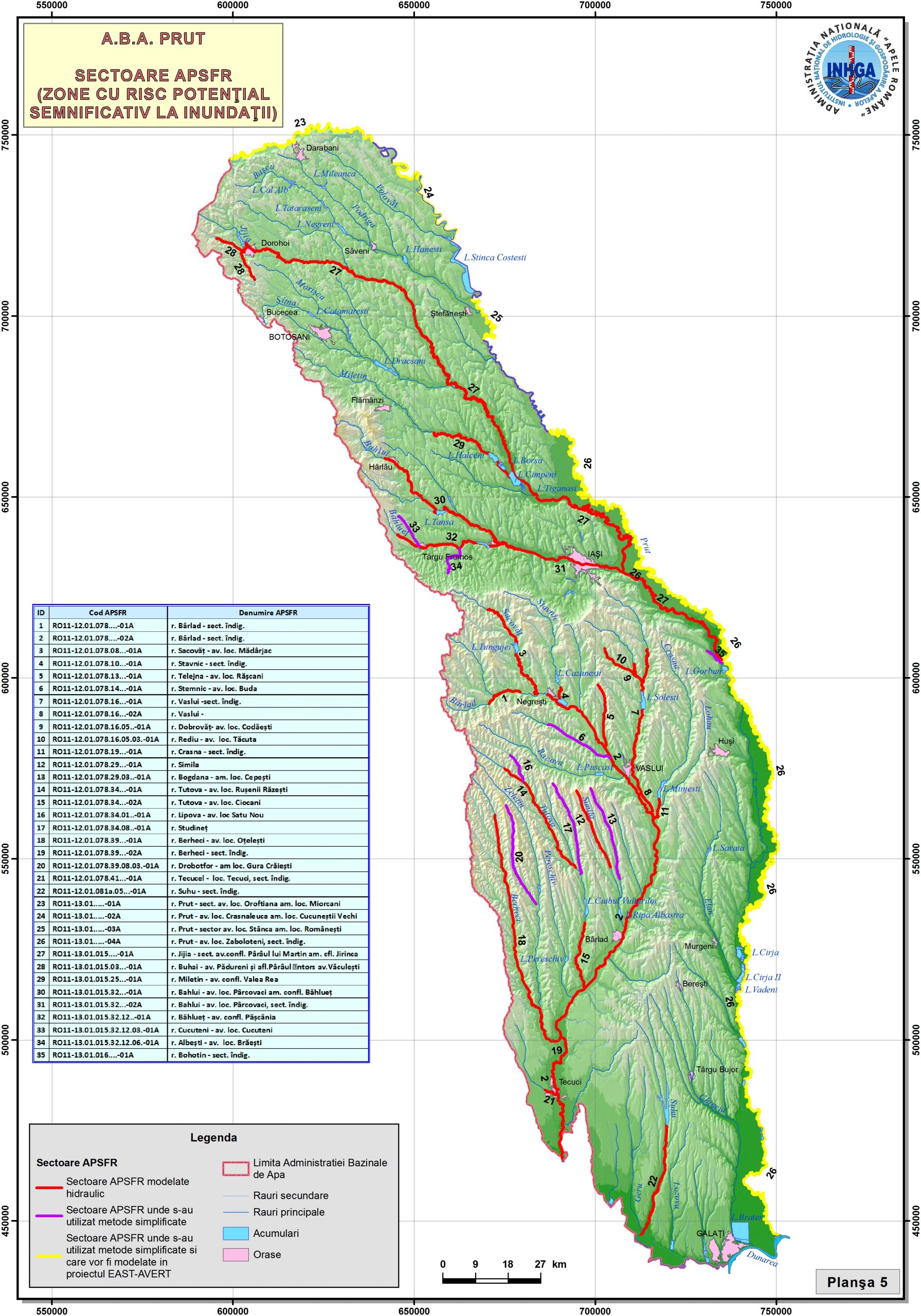
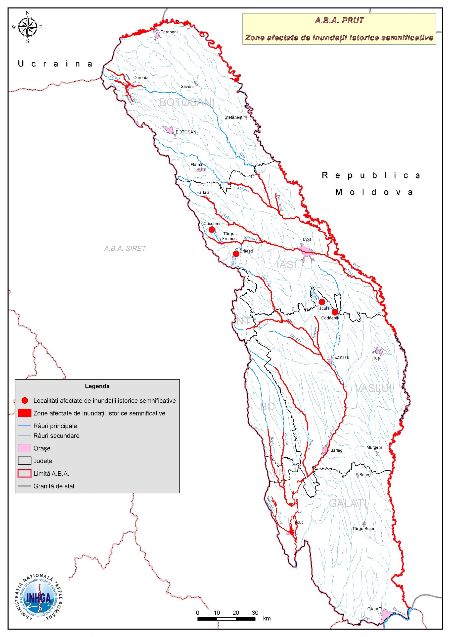
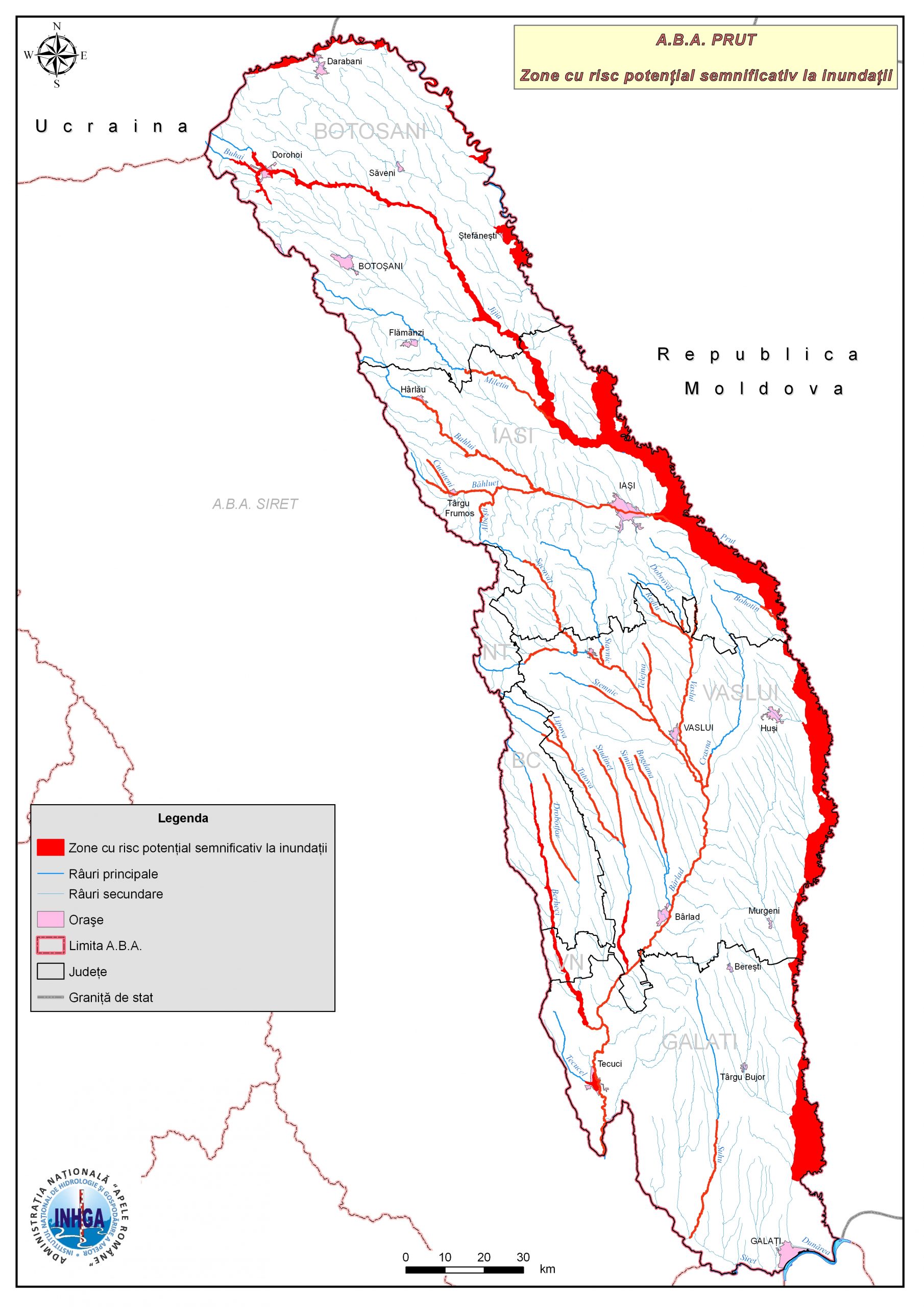
- 12-Floods-historical-significant-hydrographic-basins-ABA-Prut
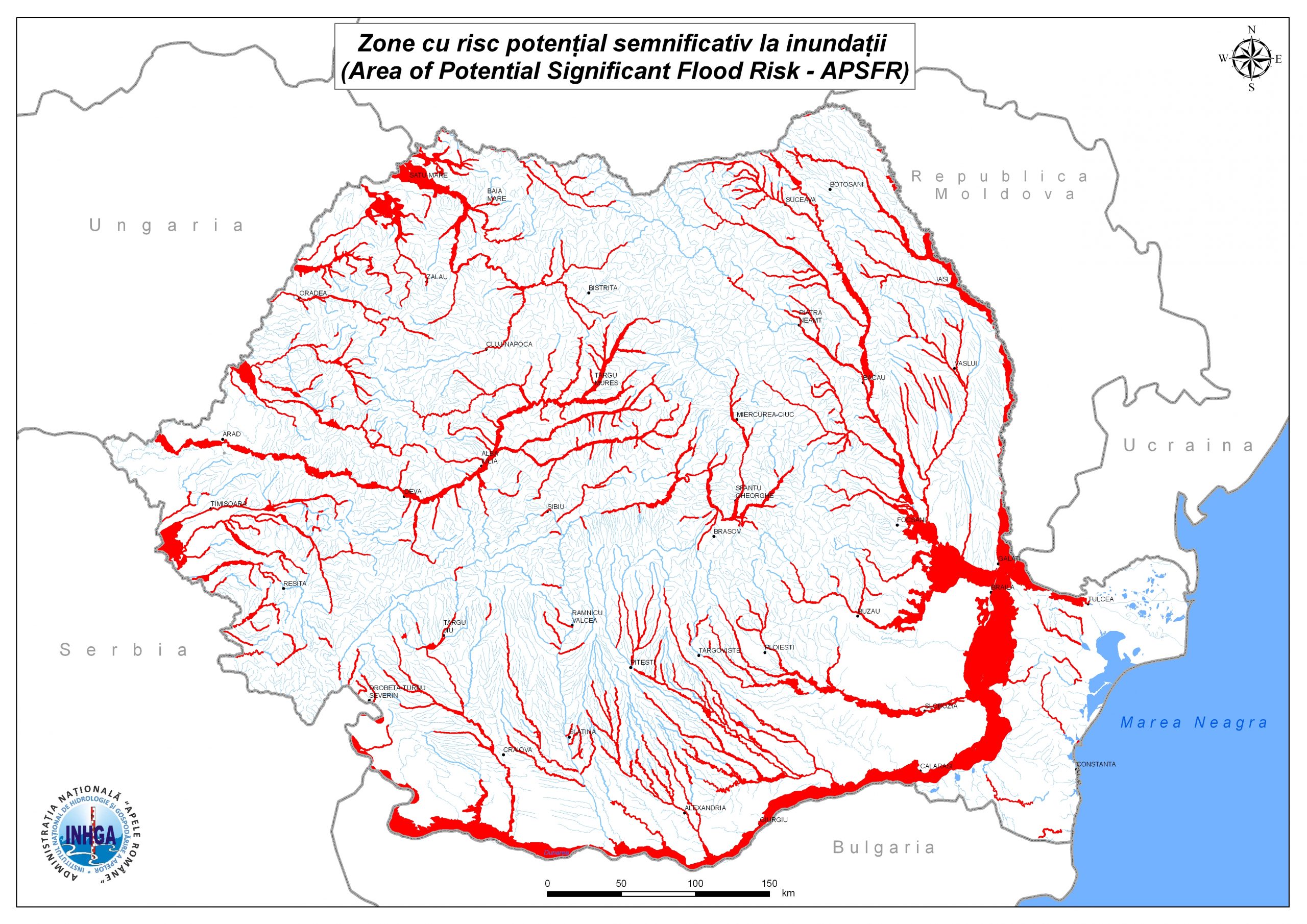
1000-Areas-with-potentially-significant-risk-to-floods-Danube Basin
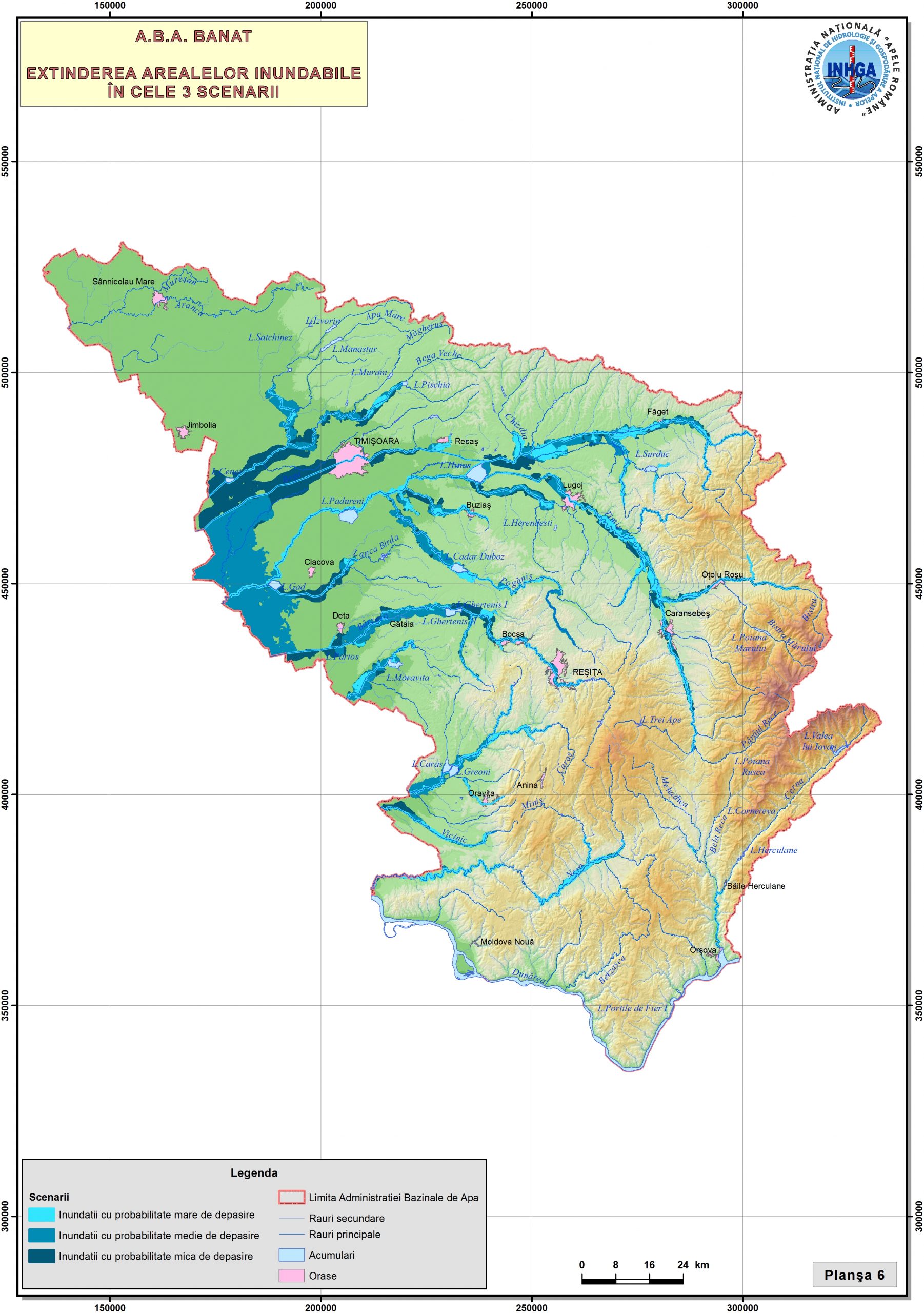
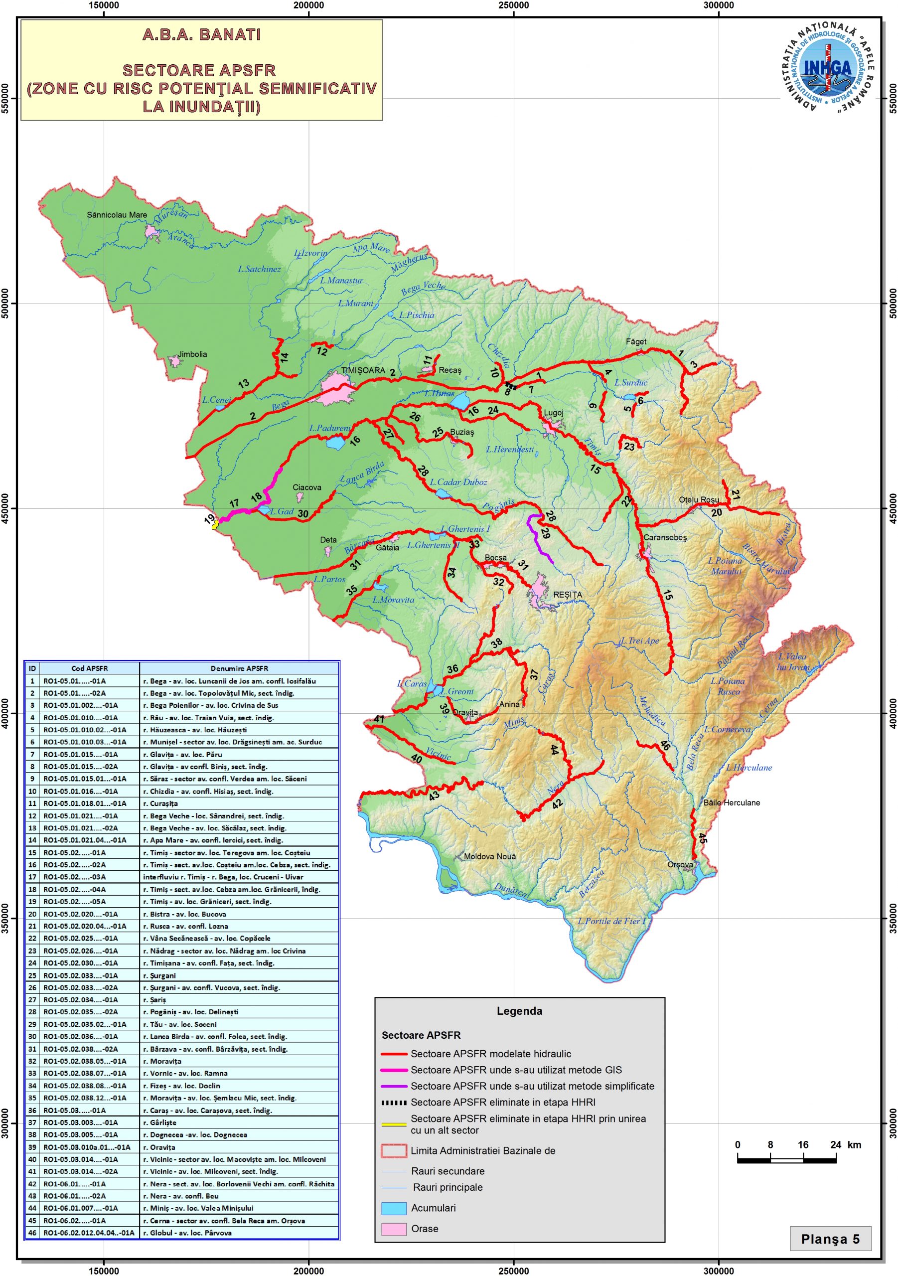
01-Areas-with-potential-significant-risk-to-flood-ABA-Banat
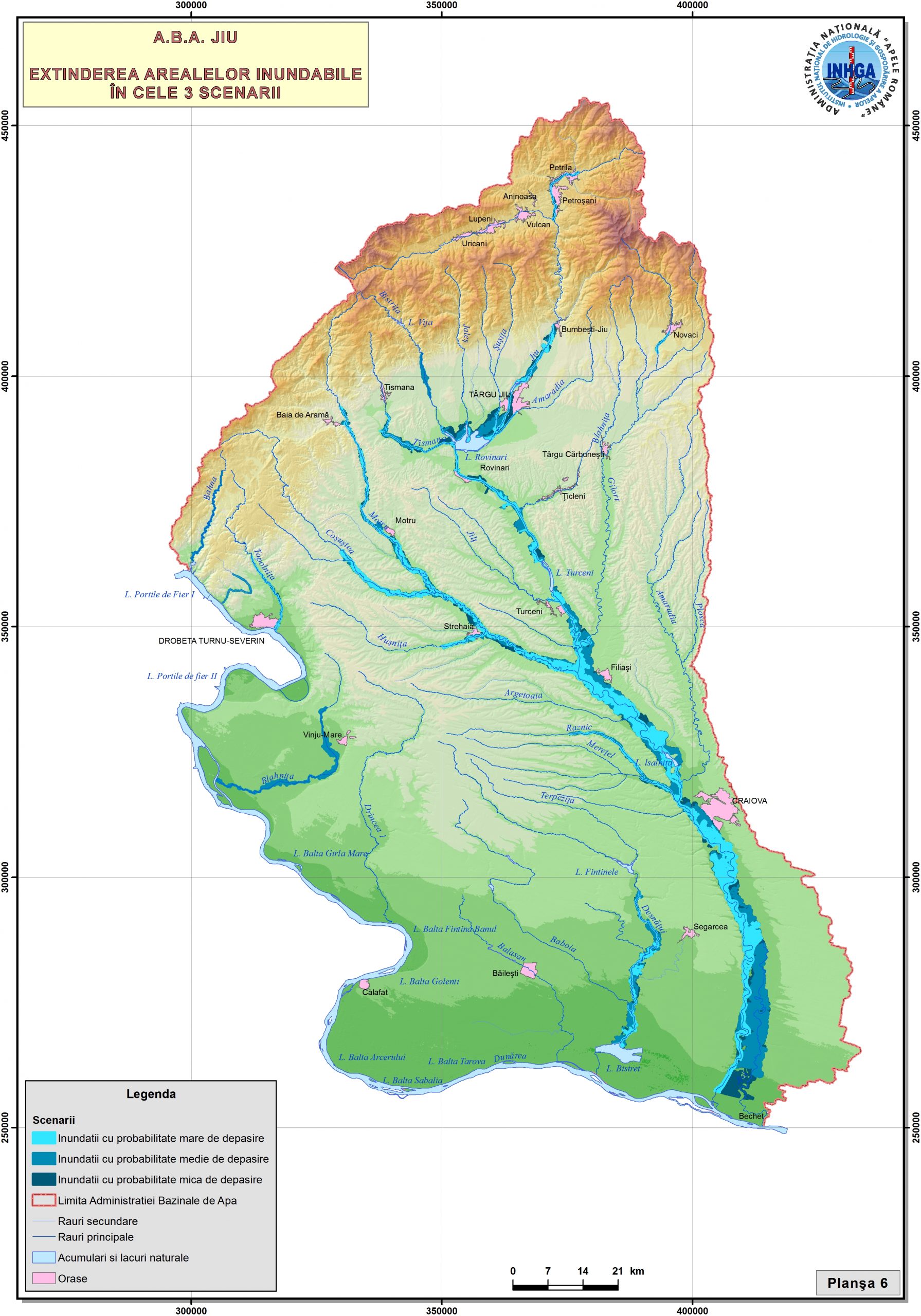
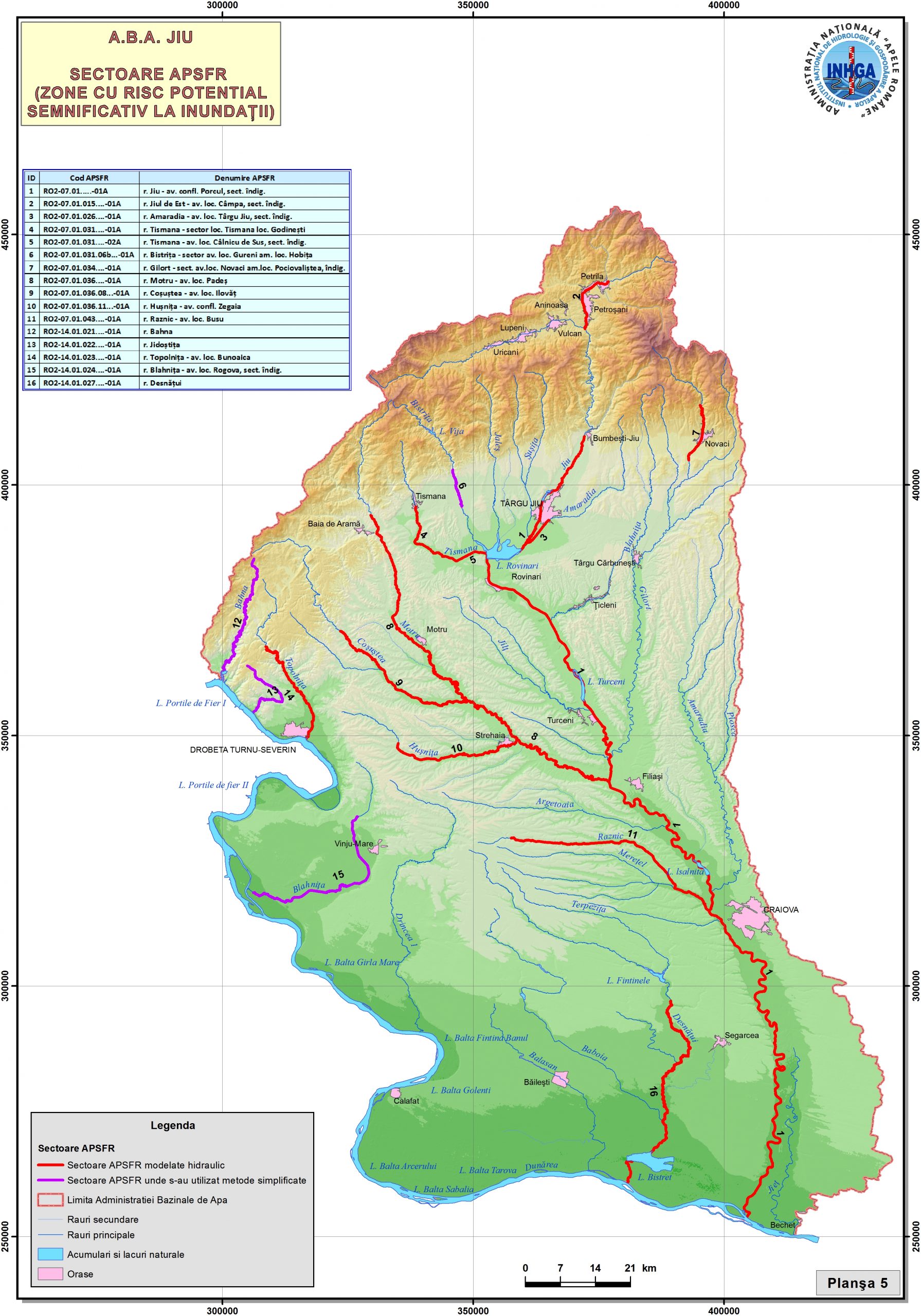
02-Areas-with-potentially-significant-risk-to-flood-ABA-Jiu
03-Areas-with-potential-significant-risk-to-flood-ABA-Olt
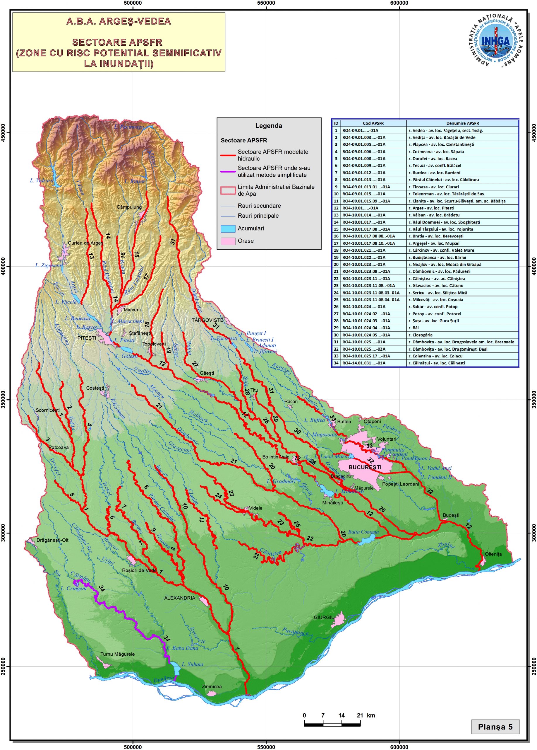
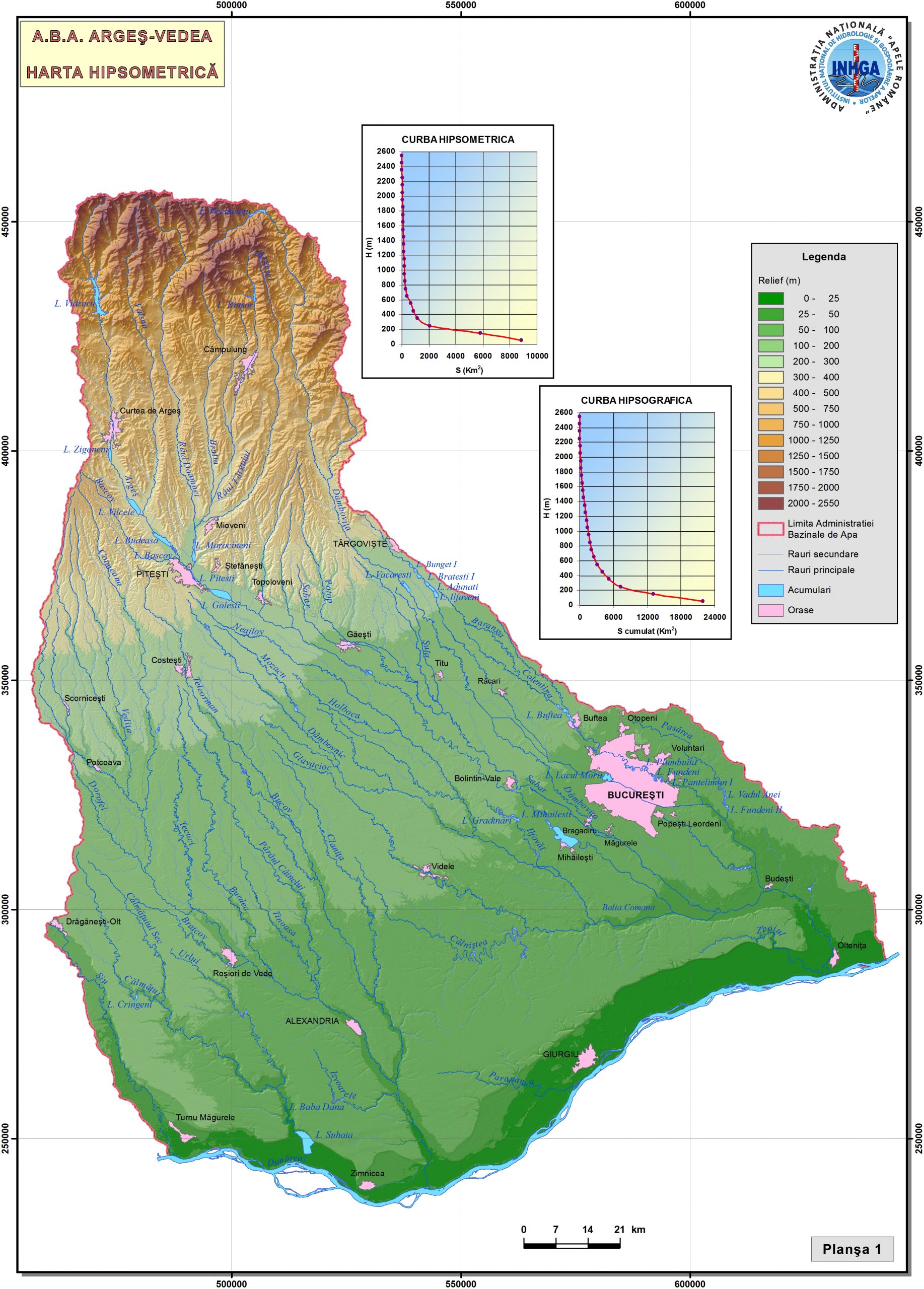
04-Areas-with-potential-significant-risk-to-flood-ABA-Arges-Vedea
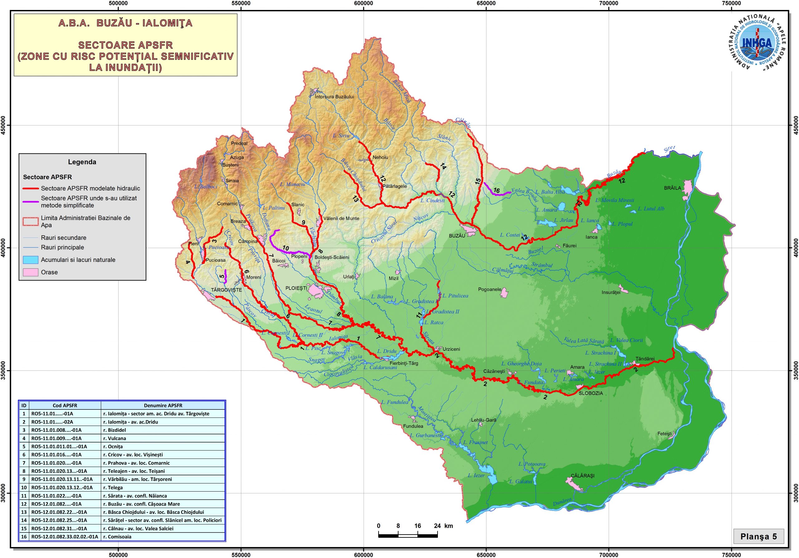
05-Areas-with-potentially-significant-risk-to-flood-ABA-Buzau-Ialomita
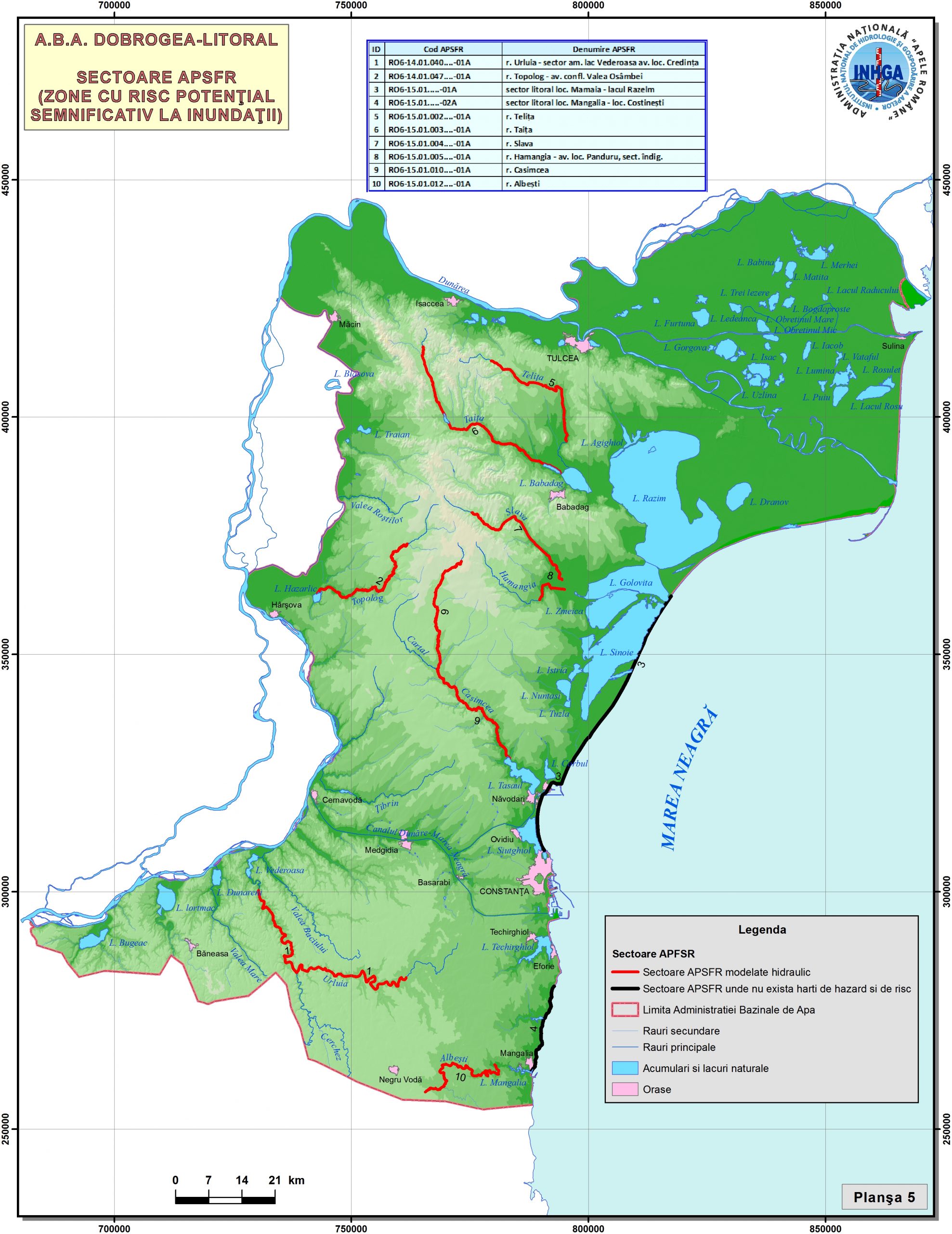
06-Areas-with-potential-significant-risk-to-flood-ABA-Dobrogea-Seaside
07-Areas-with-potential-significant-risk-to-flood-ABA-Mures
08-Areas-with-potentially-significant-risk-to-flood-ABA-Crisuri
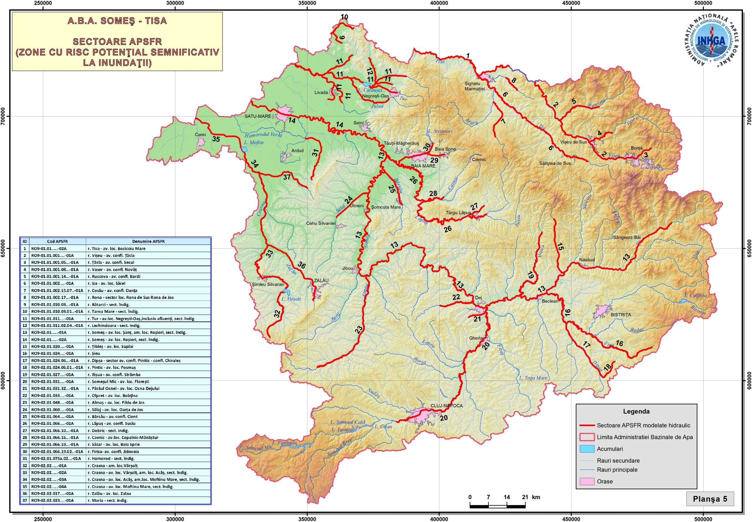
09-Areas-with-potential-significant-risk-to-flood-ABA-Somes-Tisa
11-Areas-with-potentially-significant-risk-to-flood-ABA-Siret
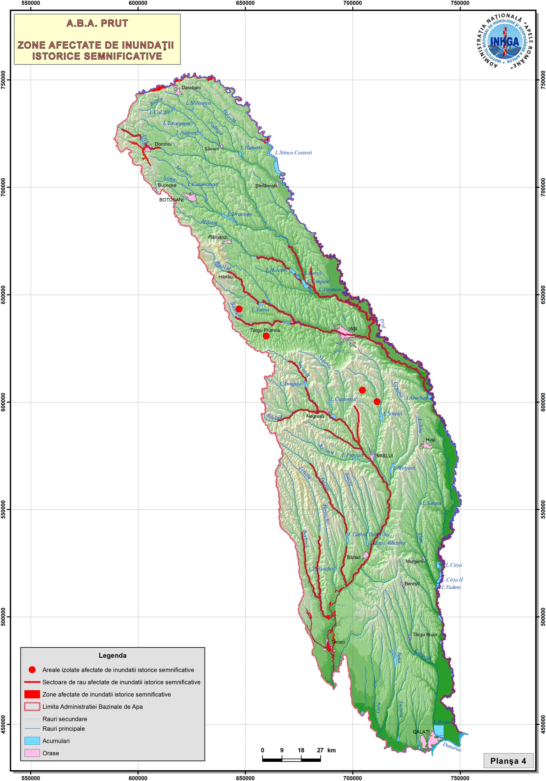
12-Areas-with-potential-significant-risk-to-flood-ABA-Prut-Barlad